Miller Atlas, c1519
Bildnummer 12916182
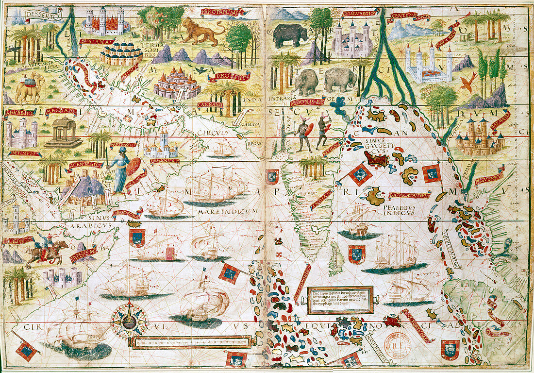
| Miller Atlas, c1519. The Portuguese Miller Atlas was discovered in France in 19th century, although its origins are uncertain. It shows the Indian Ocean, the Persian Gulf, India and North Africa, and was produced immediately after early Portuguese expeditions by da Gama, Cabral, Coehlo and Albuquerque (1489-1515). | |
| Lizenzart: | Lizenzpflichtig |
| Credit: | Science Photo Library / Heritage Images / Ann Ronan Picture Library |
| Bildgröße: | 5009 px × 3496 px |
| Modell-Rechte: | nicht erforderlich |
| Eigentums-Rechte: | nicht erforderlich |
| Restrictions: | - |
Preise für dieses Bild ab 15 €
Universitäten & Organisationen
(Informationsmaterial Digital, Informationsmaterial Print, Lehrmaterial Digital etc.)
ab 15 €
Redaktionell
(Bücher, Bücher: Sach- und Fachliteratur, Digitale Medien (redaktionell) etc.)
ab 30 €
Werbung
(Anzeigen, Aussenwerbung, Digitale Medien, Fernsehwerbung, Karten, Werbemittel, Zeitschriften etc.)
ab 55 €
Handelsprodukte
(bedruckte Textilie, Kalender, Postkarte, Grußkarte, Verpackung etc.)
ab 75 €
Pauschalpreise
Rechtepakete für die unbeschränkte Bildnutzung in Print oder Online
ab 495 €
Keywords
- 1500er Jahre,
- 16. Jahrhundert,
- Atlas,
- Baum,
- Dschungel,
- Entdeckung,
- Erkundung,
- Exotisch,
- Fauna,
- geografisch,
- Geographie,
- geographische Eigenschaft,
- Geschichte,
- historisch,
- Illustration,
- Jahrhundert,
- Kamel,
- Kamele,
- Karte,
- Kontinent,
- Konzept,
- Kunstwerk,
- Land,
- Meer,
- Natur,
- Navigation,
- Pflanze,
- Portugal,
- Portugiesisch,
- Sechzehntes Jahrhundert,
- Tier,
- Tiere,
- Vasco da Gama,
- Welt