Earth's volcanoes and tectonic boundaries, illustration
Bildnummer 12553528
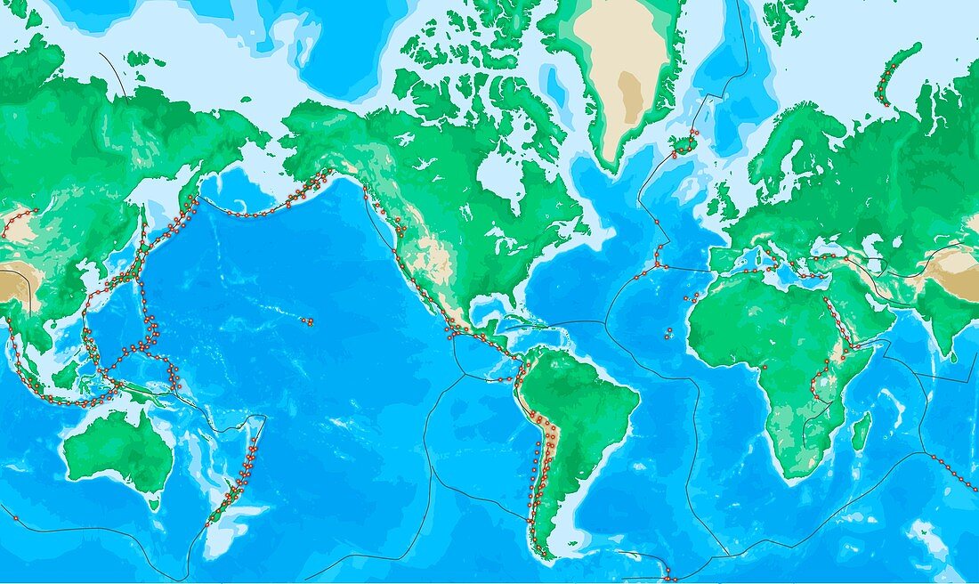
| Earth's volcanoes and fault lines. Map of the Earth, centred on the American continents, showing the location of earthquakes (red dots) and the boundaries (black lines) of the tectonic plates that make up the Earth's crust. These tectonic plates move over the molten rock below them, colliding with and moving past, under and over each other. Immense pressures can build up, which are released during an earthquake. Where a plate is being destroyed under another one (seen around the Pacific Ocean), volcanoes form as the molten rock rises to the surface. Volcanoes can also form at isolated hotspots, such as Hawaii (centre left). | |
| Lizenzart: | Lizenzpflichtig |
| Credit: | Science Photo Library / TIM BROWN |
| Bildgröße: | 7087 px × 4225 px |
| Modell-Rechte: | nicht erforderlich |
| Eigentums-Rechte: | nicht erforderlich |
| Restrictions: | - |
Preise für dieses Bild ab 15 €
Universitäten & Organisationen
(Informationsmaterial Digital, Informationsmaterial Print, Lehrmaterial Digital etc.)
ab 15 €
Redaktionell
(Bücher, Bücher: Sach- und Fachliteratur, Digitale Medien (redaktionell) etc.)
ab 30 €
Werbung
(Anzeigen, Aussenwerbung, Digitale Medien, Fernsehwerbung, Karten, Werbemittel, Zeitschriften etc.)
ab 55 €
Handelsprodukte
(bedruckte Textilie, Kalender, Postkarte, Grußkarte, Verpackung etc.)
ab 75 €
Pauschalpreise
Rechtepakete für die unbeschränkte Bildnutzung in Print oder Online
ab 495 €
Keywords
- Afrika,
- Afrikanisch,
- Asiatisch,
- Asien,
- Atlantisch,
- Australien,
- australisch,
- Erde,
- Erdkunde,
- Eurasien,
- Eurasisch,
- Europa,
- europäisch,
- Geologie,
- geologisch,
- Grenzen,
- Hawaii,
- hawaiisch,
- Hotspot,
- Illustration,
- Indisch,
- Karte,
- Kontinent,
- Kontinente,
- Kunstwerk,
- Meer,
- mehrere,
- Nordamerika,
- nordamerikanisch,
- Ozean,
- Ozeane,
- Pazifik,
- Planet,
- planetarisch,
- Seismologie,
- Südamerika,
- Südamerikanisch,
- tektonischen Platten,
- viele,
- Vulkan,
- Vulkane,
- vulkanisch,
- Vulkanologie,
- weltweit