Kilauea eruption map, 30 April 2018
Bildnummer 12492740
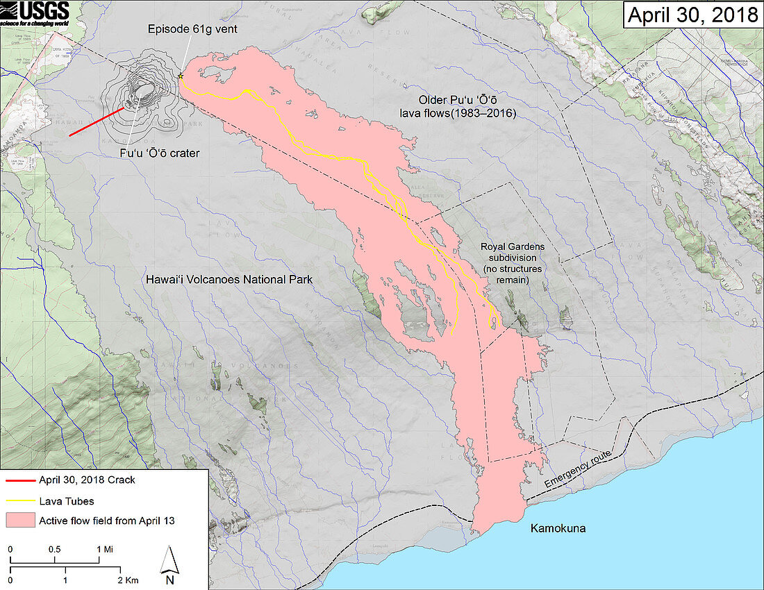
| Kilauea eruption map, 30 April 2018. Kilauea is a volcano on the main island of Hawaii. Features shown on this map include the Puu Oo crack that occurred at Kilauea's Puu Oo crater (upper left), as well as recent changes to Kilauea's East Rift Zone lava flow field. The 61g flow field, as of 13 April 2018, is shown in pink. The crack that formed on the west side of Puu Oo on 30 April 2018, during or immediately after the crater floor collapse, is shown as a solid red line. Older Puu Oo lava flows (1983–2016) are shown in gray. The yellow line is the trace of the active lava tubes. The blue lines are steepest-descent paths calculated from a 2013 digital elevation model (DEM), while the blue lines on the rest of the map are steepest-descent paths calculated from a 1983 DEM. | |
| Lizenzart: | Lizenzpflichtig |
| Credit: | Science Photo Library / US Geological Survey |
| Bildgröße: | 3500 px × 2705 px |
| Modell-Rechte: | nicht erforderlich |
| Eigentums-Rechte: | nicht erforderlich |
| Restrictions: | - |
Preise für dieses Bild ab 15 €
Universitäten & Organisationen
(Informationsmaterial Digital, Informationsmaterial Print, Lehrmaterial Digital etc.)
ab 15 €
Redaktionell
(Bücher, Bücher: Sach- und Fachliteratur, Digitale Medien (redaktionell) etc.)
ab 30 €
Werbung
(Anzeigen, Aussenwerbung, Digitale Medien, Fernsehwerbung, Karten, Werbemittel, Zeitschriften etc.)
ab 55 €
Handelsprodukte
(bedruckte Textilie, Kalender, Postkarte, Grußkarte, Verpackung etc.)
ab 75 €
Pauschalpreise
Rechtepakete für die unbeschränkte Bildnutzung in Print oder Online
ab 495 €