Persian map of the world, after Ptolemy, 13th century
Bildnummer 12450104
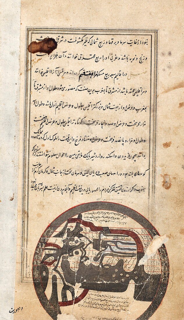
| Persian map of the world, after Ptolemy, 13th century. This map, based on the world map produced by Greek astronomer Ptolemy in around 150 AD, is from a manuscript by Persian astronomer and geographer Zakariya al-Qazwini. It dates from between 1220 and 1283, and is thought to have been created in Shiraz (in modern-day Iran). The map (bottom) is annotated with Persian text. It depicts the Islamic world, centred upon the Indian Ocean, with North at top and the Mediterranean Sea at left. This page is from al-Qazwini's work 'Aja'ib al-makhluqat va ghara'ib al-mawjudat' ('Marvels of creatures and strange things existing'). | |
| Lizenzart: | Lizenzpflichtig |
| Credit: | Science Photo Library / New York Public Library / Spencer Collection |
| Bildgröße: | 3338 px × 5807 px |
| Modell-Rechte: | nicht erforderlich |
| Eigentums-Rechte: | nicht erforderlich |
| Restrictions: | - |
Preise für dieses Bild ab 15 €
Universitäten & Organisationen
(Informationsmaterial Digital, Informationsmaterial Print, Lehrmaterial Digital etc.)
ab 15 €
Redaktionell
(Bücher, Bücher: Sach- und Fachliteratur, Digitale Medien (redaktionell) etc.)
ab 30 €
Werbung
(Anzeigen, Aussenwerbung, Digitale Medien, Fernsehwerbung, Karten, Werbemittel, Zeitschriften etc.)
ab 55 €
Handelsprodukte
(bedruckte Textilie, Kalender, Postkarte, Grußkarte, Verpackung etc.)
ab 75 €
Pauschalpreise
Rechtepakete für die unbeschränkte Bildnutzung in Print oder Online
ab 495 €
Keywords
- 13. Jahrhundert,
- Afrika,
- Afrikanisch,
- Antike,
- Asiatisch,
- Asien,
- bekannte Welt,
- Blatt,
- Buch,
- Europa,
- europäisch,
- geografisch,
- Geographie,
- Geschichte,
- historisch,
- Illustration,
- Indischer Ozean,
- islamisch,
- Karte,
- Kartographie,
- klassisch,
- Kunstwerk,
- Manuskript,
- Mittelalterlich,
- Mittelmeer,
- mittleren Alters,
- Mittlerer Osten,
- Nahost,
- Niemand,
- Persisch,
- Schreiben,
- Sprache,
- Text,
- Veröffentlichung,
- Welt,
- Weltkarte