Tibetan Himalayas, satellite image
Bildnummer 12325555
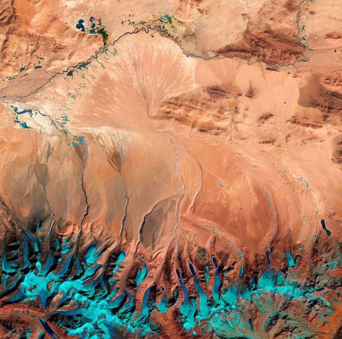
| Tibetan Himalayas. Satellite image centred over the Tibetan Plateau. This vast elevated plateau in Central and East Asia was created around 55 million years ago when the north-moving Indian Plate collided with the Eurasian Plate. At altitude above 4500 metres, it is the highest and largest plateau in the world. Imaged by the Sentinel-2A satellite, on 1st February 2016. | |
| Lizenzart: | Lizenzpflichtig |
| Credit: | Science Photo Library / ESA / Copernicus Sentinel data (2016) |
| Bildgröße: | 4235 px × 4198 px |
| Modell-Rechte: | nicht erforderlich |
| Eigentums-Rechte: | nicht erforderlich |
| Restrictions: |
|
Preise für dieses Bild ab 15 €
Universitäten & Organisationen
(Informationsmaterial Digital, Informationsmaterial Print, Lehrmaterial Digital etc.)
ab 15 €
Redaktionell
(Bücher, Bücher: Sach- und Fachliteratur, Digitale Medien (redaktionell) etc.)
ab 30 €
Werbung
(Anzeigen, Aussenwerbung, Digitale Medien, Fernsehwerbung, Karten, Werbemittel, Zeitschriften etc.)
ab 55 €
Handelsprodukte
(bedruckte Textilie, Kalender, Postkarte, Grußkarte, Verpackung etc.)
ab 75 €
Pauschalpreise
Rechtepakete für die unbeschränkte Bildnutzung in Print oder Online
ab 495 €