Map of the Ancient World,19th century
Bildnummer 11946670
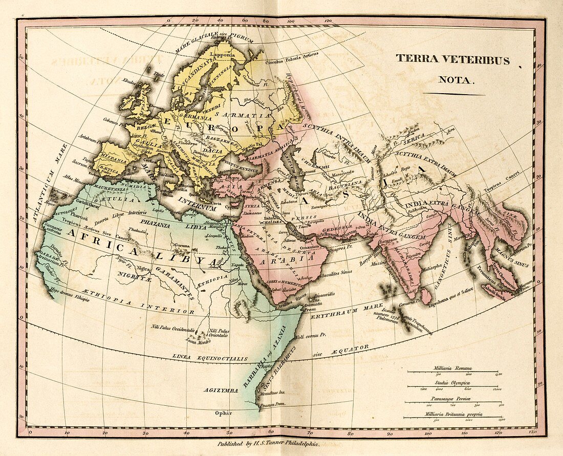
| Map of the Ancient World,19th century. This map is divided by colour into Europe (yellow),Asia (pink) and Africa (green) and labelled with the names of regions and states of antiquity. The distance scales (lower right) are in Roman miles,Greek stadia,Persian parasangs,and British miles. Published in 'An Atlas of Ancient Geography' (1826) by US cartographer Henry Schenck Tanner (1786-1858) | |
| Lizenzart: | Lizenzpflichtig |
| Credit: | Science Photo Library / LIBRARY OF CONGRESS, Geography and Map Division |
| Bildgröße: | 4658 px × 3772 px |
| Modell-Rechte: | nicht erforderlich |
| Eigentums-Rechte: | nicht erforderlich |
| Restrictions: | - |
Preise für dieses Bild ab 15 €
Universitäten & Organisationen
(Informationsmaterial Digital, Informationsmaterial Print, Lehrmaterial Digital etc.)
ab 15 €
Redaktionell
(Bücher, Bücher: Sach- und Fachliteratur, Digitale Medien (redaktionell) etc.)
ab 30 €
Werbung
(Anzeigen, Aussenwerbung, Digitale Medien, Fernsehwerbung, Karten, Werbemittel, Zeitschriften etc.)
ab 55 €
Handelsprodukte
(bedruckte Textilie, Kalender, Postkarte, Grußkarte, Verpackung etc.)
ab 75 €
Pauschalpreise
Rechtepakete für die unbeschränkte Bildnutzung in Print oder Online
ab 495 €
Keywords
- 1800er Jahre,
- 19. Jahrhundert,
- Afrika,
- Afrikanisch,
- Ägypten,
- Antike,
- antike Welt,
- Arabien,
- Asiatisch,
- Asien,
- Atlas,
- Belgien,
- Blatt,
- Buch,
- Europa,
- europäisch,
- geografisch,
- Geographie,
- Geschichte,
- Griechenland,
- historisch,
- Illustration,
- Indien,
- Italien,
- Karte,
- Kartographie,
- klassisch,
- Kunstwerk,
- Latein,
- Mauretanien,
- Mittelmeer,
- Niemand,
- Persien,
- Region,
- römische Meilen,
- Skandinavien,
- Staat,
- Truthahn,
- Veröffentlichung,
- Waage