Martian canyon,3D image
Bildnummer 11882431
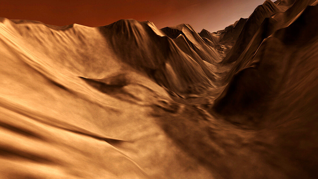
| Martian canyon,3D image based on satellite data. Perspective view of a tributary canyon of Valles Marineris,the largest canyon system on Mars. The canyon system is thought to have been formed by a combination of tectonic activity and water erosion. The canyon walls are many kilometres high. This image was generated using infrared data from the Mars Odyssey spacecraft's Thermal Emission Imaging System,and topographical data from the Mars Global Surveyor spacecraft's Mars Orbiter Laser Altimeter,both of which are in orbit around Mars | |
| Lizenzart: | Lizenzpflichtig |
| Credit: | Science Photo Library / ARIZONA STATE UNIVERSITY / JPL / NASA |
| Bildgröße: | 3939 px × 2216 px |
| Modell-Rechte: | nicht erforderlich |
| Eigentums-Rechte: | nicht erforderlich |
| Restrictions: | - |
Preise für dieses Bild ab 15 €
Universitäten & Organisationen
(Informationsmaterial Digital, Informationsmaterial Print, Lehrmaterial Digital etc.)
ab 15 €
Redaktionell
(Bücher, Bücher: Sach- und Fachliteratur, Digitale Medien (redaktionell) etc.)
ab 30 €
Werbung
(Anzeigen, Aussenwerbung, Digitale Medien, Fernsehwerbung, Karten, Werbemittel, Zeitschriften etc.)
ab 55 €
Handelsprodukte
(bedruckte Textilie, Kalender, Postkarte, Grußkarte, Verpackung etc.)
ab 75 €
Pauschalpreise
Rechtepakete für die unbeschränkte Bildnutzung in Print oder Online
ab 495 €