3-D topography of Mars
Bildnummer 11882269
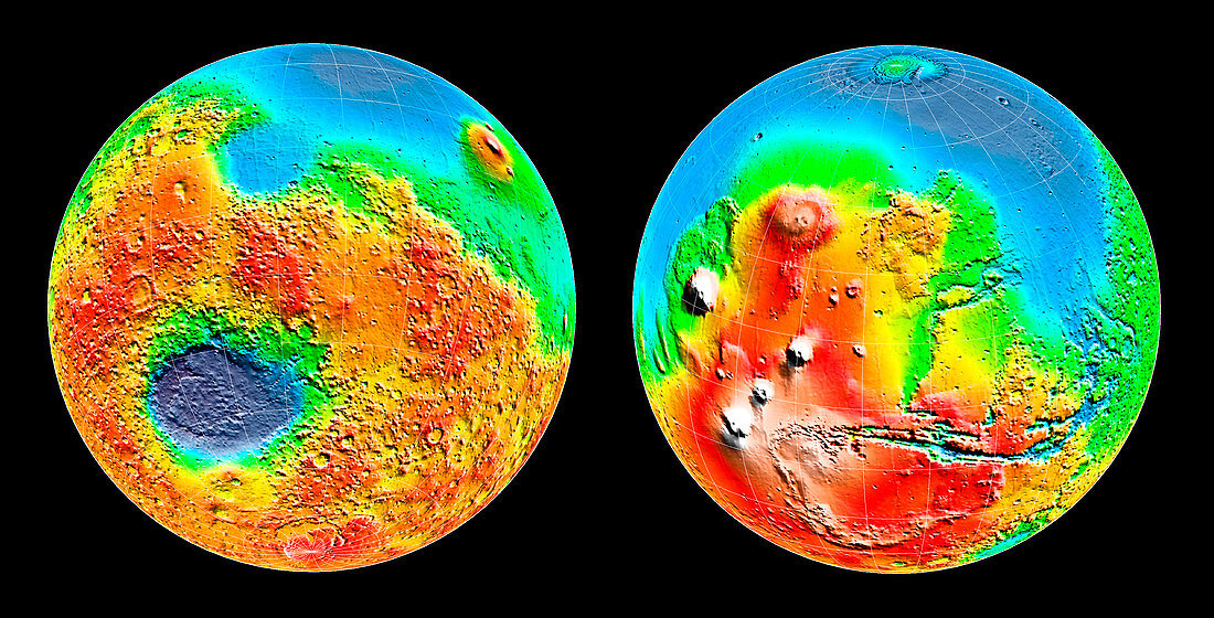
| Mars global topography. Three-dimensional map of Mars showing the topography of the entire planet. The south pole is at the bottom of the left image,with the north pole at the top of the right one. The colour-coding shows the height of the terrain relative to the average elevation at the equator. Yellow areas are of average height while red to white areas higher and green to blue lower. Mars' enormous volcanoes can be seen at the left of the right image. This data was recorded by the Mars Orbiter Laser Altimeter (MOLA) on board the Mars Global Surveyor. 27 million measurements accurate to within 13 metres were made in 1998 and 1999 by timing laser pulses sent to Mars' surface | |
| Lizenzart: | Lizenzpflichtig |
| Credit: | Science Photo Library / NASA |
| Bildgröße: | 3364 px × 1712 px |
| Modell-Rechte: | nicht erforderlich |
| Eigentums-Rechte: | nicht erforderlich |
| Restrictions: | - |
Preise für dieses Bild ab 15 €
Universitäten & Organisationen
(Informationsmaterial Digital, Informationsmaterial Print, Lehrmaterial Digital etc.)
ab 15 €
Redaktionell
(Bücher, Bücher: Sach- und Fachliteratur, Digitale Medien (redaktionell) etc.)
ab 30 €
Werbung
(Anzeigen, Aussenwerbung, Digitale Medien, Fernsehwerbung, Karten, Werbemittel, Zeitschriften etc.)
ab 55 €
Handelsprodukte
(bedruckte Textilie, Kalender, Postkarte, Grußkarte, Verpackung etc.)
ab 75 €
Pauschalpreise
Rechtepakete für die unbeschränkte Bildnutzung in Print oder Online
ab 495 €