Corona on surface of Venus
Bildnummer 11881728
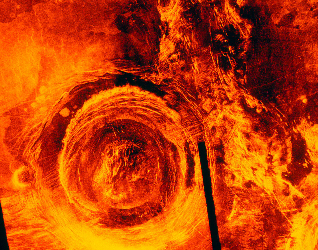
| False-colour image of a corona on the surface of Venus,made by the Magellan radar-mapping spacecraft in 1991. The corona is situated about 1000km south of the equatorial continent Aphrodite Terra. It is about 375km in diameter,and flanks a north-south trending fault zone. The corona is thought to have been produced as a result of up- swelling of the surface by molten lava,creating a dome. As the dome cools,it collapses to form the corona. Coronae are generally found on lava plains. Just to the west (left) of the corona is a later dome made of lava that has reached the surface through a fissure. The black line is an area where insufficient data were gathered | |
| Lizenzart: | Lizenzpflichtig |
| Credit: | Science Photo Library / NASA |
| Bildgröße: | 3543 px × 2780 px |
| Modell-Rechte: | nicht erforderlich |
| Eigentums-Rechte: | nicht erforderlich |
| Restrictions: | - |
Preise für dieses Bild ab 15 €
Universitäten & Organisationen
(Informationsmaterial Digital, Informationsmaterial Print, Lehrmaterial Digital etc.)
ab 15 €
Redaktionell
(Bücher, Bücher: Sach- und Fachliteratur, Digitale Medien (redaktionell) etc.)
ab 30 €
Werbung
(Anzeigen, Aussenwerbung, Digitale Medien, Fernsehwerbung, Karten, Werbemittel, Zeitschriften etc.)
ab 55 €
Handelsprodukte
(bedruckte Textilie, Kalender, Postkarte, Grußkarte, Verpackung etc.)
ab 75 €
Pauschalpreise
Rechtepakete für die unbeschränkte Bildnutzung in Print oder Online
ab 495 €