Point Loma,California,USA
Bildnummer 11748928
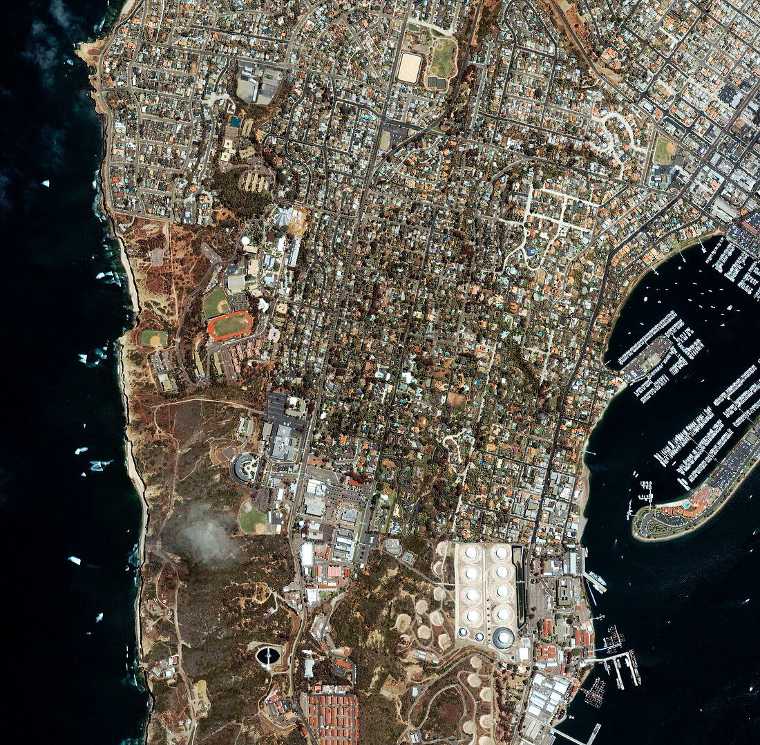
| Point Loma. Satellite image of the northern part of Point Loma,an area of San Diego,California,USA. North is at top. The area across bottom is part of Fort Rosecrans Military Reservation. The area at centre left,around an athletics track,is Point Loma Nazarene University. The housing in the rest of the image is suburbs of San Diego. The docks at far right are Shelter Island Marina. The Pacific coast is at left,and San Diego Bay is at right. Point Loma tapers to a headland (off bottom of image) where there is a memorial to the arrival (in 1542) of the Spanish explorer Juan Rodriguez Cabrillo. The area seen is some 3 kilometres wide. Image taken by the Ikonos satellite,10 June 2001 | |
| Lizenzart: | Lizenzpflichtig |
| Credit: | Science Photo Library / Geoeye |
| Bildgröße: | 3000 px × 2940 px |
| Modell-Rechte: | nicht erforderlich |
| Eigentums-Rechte: | nicht erforderlich |
| Restrictions: | - |
Preise für dieses Bild ab 15 €
Universitäten & Organisationen
(Informationsmaterial Digital, Informationsmaterial Print, Lehrmaterial Digital etc.)
ab 15 €
Redaktionell
(Bücher, Bücher: Sach- und Fachliteratur, Digitale Medien (redaktionell) etc.)
ab 30 €
Werbung
(Anzeigen, Aussenwerbung, Digitale Medien, Fernsehwerbung, Karten, Werbemittel, Zeitschriften etc.)
ab 55 €
Handelsprodukte
(bedruckte Textilie, Kalender, Postkarte, Grußkarte, Verpackung etc.)
ab 75 €
Pauschalpreise
Rechtepakete für die unbeschränkte Bildnutzung in Print oder Online
ab 495 €