Coloured radar satellite image of Bucharest
Bildnummer 11748677
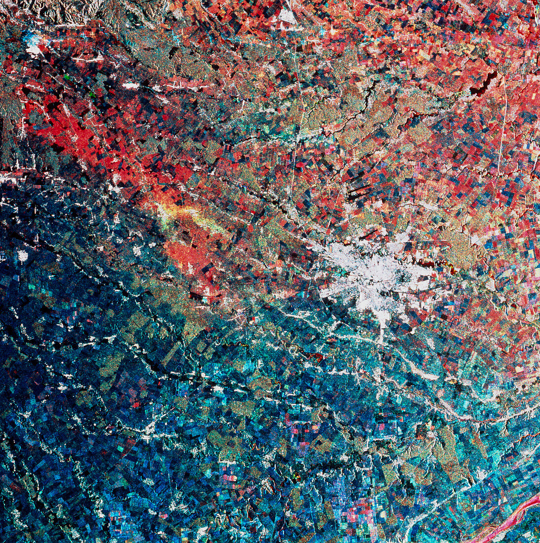
| Bucharest. Coloured radar satellite image of Bucharest (centre right,white),capital and largest city of Romania. North is towards the top. This image was made by combining three frames taken on different dates. Differences between the frames show as areas of colour. Farmland,for example,appears red,blue or green,the different colours indicating crops grown and harvested at different times of the year. The wriggly black line running through the city is the River Dambovit. This image was produced by European Radar Satellite 1. The area shown is approximately 100km x 100km | |
| Lizenzart: | Lizenzpflichtig |
| Credit: | Science Photo Library / ESA, EURIMAGE |
| Bildgröße: | 4469 px × 4488 px |
| Modell-Rechte: | nicht erforderlich |
| Eigentums-Rechte: | nicht erforderlich |
| Restrictions: |
|
Preise für dieses Bild ab 15 €
Universitäten & Organisationen
(Informationsmaterial Digital, Informationsmaterial Print, Lehrmaterial Digital etc.)
ab 15 €
Redaktionell
(Bücher, Bücher: Sach- und Fachliteratur, Digitale Medien (redaktionell) etc.)
ab 30 €
Werbung
(Anzeigen, Aussenwerbung, Digitale Medien, Fernsehwerbung, Karten, Werbemittel, Zeitschriften etc.)
ab 55 €
Handelsprodukte
(bedruckte Textilie, Kalender, Postkarte, Grußkarte, Verpackung etc.)
ab 75 €
Pauschalpreise
Rechtepakete für die unbeschränkte Bildnutzung in Print oder Online
ab 495 €