Agriculture and desert
Bildnummer 11747917
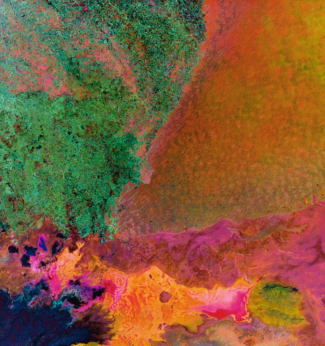
| Agriculture and desert,Pakistan,satellite image. North is at top. Desert sands (yellow,upper right) contrast with agricultural fields (green,upper left). Water (dark blue) in the fields comes from the Mithrani Canal system that brings water from the Indus River to the north and west. Wetlands and salt flats (multi-coloured,across bottom) form part of the Rann of Kachchh on the Pakistan-India border. The sand is part of the Thar Desert. This area lies south of the city of Mirpur Khas,Pakistan. This 180-kilometre-wide image was taken on 7 March 1973 by NASA's Landsat 1 satellite | |
| Lizenzart: | Lizenzpflichtig |
| Credit: | Science Photo Library / MDA Information Systems |
| Bildgröße: | 4050 px × 4313 px |
| Modell-Rechte: | nicht erforderlich |
| Eigentums-Rechte: | nicht erforderlich |
| Restrictions: | - |
Preise für dieses Bild ab 15 €
Universitäten & Organisationen
(Informationsmaterial Digital, Informationsmaterial Print, Lehrmaterial Digital etc.)
ab 15 €
Redaktionell
(Bücher, Bücher: Sach- und Fachliteratur, Digitale Medien (redaktionell) etc.)
ab 30 €
Werbung
(Anzeigen, Aussenwerbung, Digitale Medien, Fernsehwerbung, Karten, Werbemittel, Zeitschriften etc.)
ab 55 €
Handelsprodukte
(bedruckte Textilie, Kalender, Postkarte, Grußkarte, Verpackung etc.)
ab 75 €
Pauschalpreise
Rechtepakete für die unbeschränkte Bildnutzung in Print oder Online
ab 495 €
Keywords
- Anbau,
- Asiatisch,
- Asien,
- Bauernhof,
- Bauernhöfe,
- bewässert,
- Bewässerung,
- Bodennutzung,
- einer,
- Erdbeobachtung,
- Feld,
- Felder,
- Feuchtgebiete,
- Frühling,
- geografisch,
- Geographie,
- Indien,
- Indisch,
- infrarot,
- Kanal,
- Kontrast,
- kultiviert,
- Landsat 1,
- Landwirtschaft,
- landwirtschaftlich,
- März,
- mechanisiert,
- mss,
- Multispektral,
- Pakistan,
- Rand,
- Sand,
- sandig,
- Satellit,
- trocken,
- Umwelt,
- Wasser,
- Weltall,
- Wüste