Baja California,satellite mosaic
Bildnummer 11746463
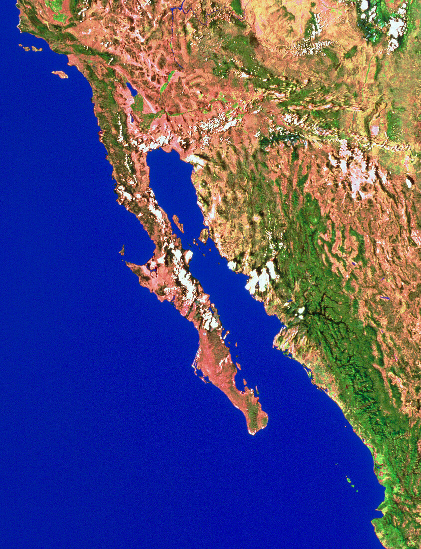
| Baja California. Mosaic of satellite images showing the 1000-km long peninsula,Baja California in Mexico. Baja California was produced by the action of the destructive plate boundary running the whole length of the Pacific Coast of North America. Between the peninsula and the mainland is the Gulf of California. The San Andreas fault runs along the line of the gulf. The brownish areas at top and right are part of the Sierra Madre mountains. The data for this image were gathered by NOAA weather satellites | |
| Lizenzart: | Lizenzpflichtig |
| Credit: | Science Photo Library / Worldsat International |
| Bildgröße: | 3800 px × 4961 px |
| Modell-Rechte: | nicht erforderlich |
| Eigentums-Rechte: | nicht erforderlich |
| Restrictions: |
|
Preise für dieses Bild ab 15 €
Universitäten & Organisationen
(Informationsmaterial Digital, Informationsmaterial Print, Lehrmaterial Digital etc.)
ab 15 €
Redaktionell
(Bücher, Bücher: Sach- und Fachliteratur, Digitale Medien (redaktionell) etc.)
ab 30 €
Werbung
(Anzeigen, Aussenwerbung, Digitale Medien, Fernsehwerbung, Karten, Werbemittel, Zeitschriften etc.)
ab 55 €
Handelsprodukte
(bedruckte Textilie, Kalender, Postkarte, Grußkarte, Verpackung etc.)
ab 75 €
Pauschalpreise
Rechtepakete für die unbeschränkte Bildnutzung in Print oder Online
ab 495 €