Desert terrain in the United Arab Emirates
Bildnummer 11745739
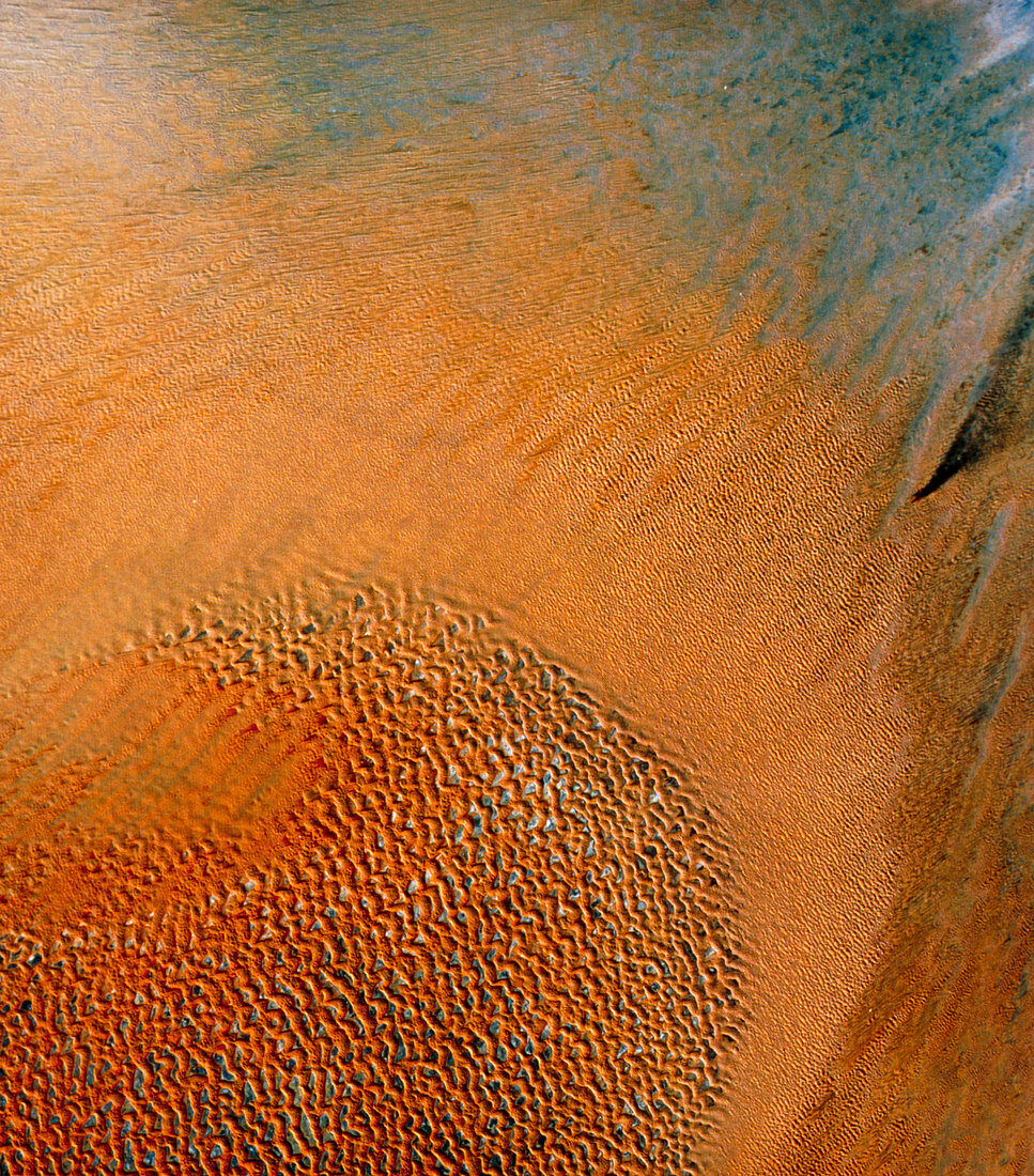
| Arabian desert. Infrared satellite image of the Arabian desert. At top centre is a smoke plume (black) from a burning oil well flare. Flares are used to burn off gases that are found in oil deposits but which are commercially unviable to collect. Also visible are various types of sand dunes. Image of the Bu Hasa oilfield in the United Arab Emirates,taken by the American Landsat satellite | |
| Lizenzart: | Lizenzpflichtig |
| Credit: | Science Photo Library / MDA Information Systems |
| Bildgröße: | 4359 px × 4961 px |
| Modell-Rechte: | nicht erforderlich |
| Eigentums-Rechte: | nicht erforderlich |
| Restrictions: | - |
Preise für dieses Bild ab 15 €
Universitäten & Organisationen
(Informationsmaterial Digital, Informationsmaterial Print, Lehrmaterial Digital etc.)
ab 15 €
Redaktionell
(Bücher, Bücher: Sach- und Fachliteratur, Digitale Medien (redaktionell) etc.)
ab 30 €
Werbung
(Anzeigen, Aussenwerbung, Digitale Medien, Fernsehwerbung, Karten, Werbemittel, Zeitschriften etc.)
ab 55 €
Handelsprodukte
(bedruckte Textilie, Kalender, Postkarte, Grußkarte, Verpackung etc.)
ab 75 €
Pauschalpreise
Rechtepakete für die unbeschränkte Bildnutzung in Print oder Online
ab 495 €