Eroded mountains
Bildnummer 11741325
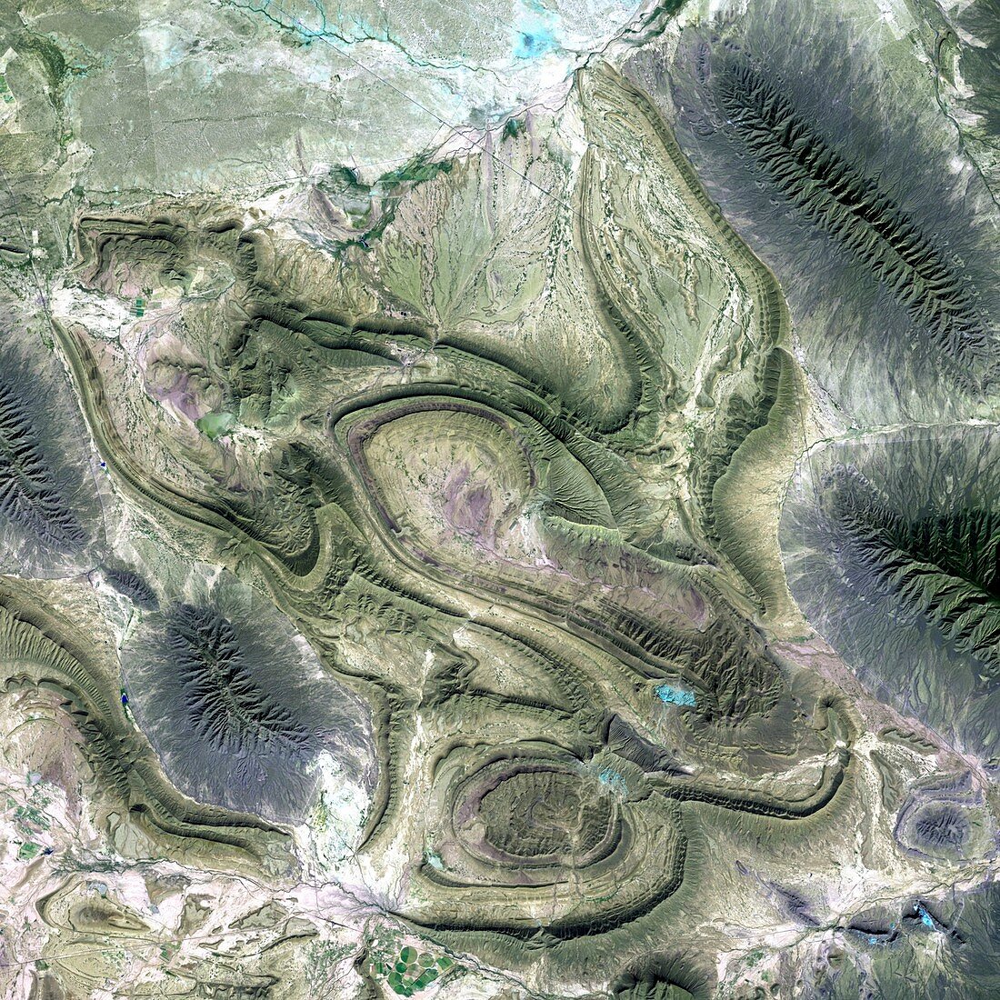
| Eroded mountains,satellite image. Ridges of rock (green) and heavily eroded mountain spurs (grey) are seen in this image. The ridges show both the rock layers (strata) and the twisted patterns that formed as tectonic forces buckled the Earth's crust. Varying resistance to later erosion has now revealed these strata. Deeply etched valleys are seen on the sides of the mountain spurs. These are part of the Sierra Madre Oriental mountain range,and this image was taken on the border between the Coahuila and Nuevo Leon provinces of Mexico. Image taken on 28 November 1999,in visible and infrared wavelengths,by the Enhanced Thematic Mapper Plus (ETM+) sensor on NASA's Landsat 7 satellite | |
| Lizenzart: | Lizenzpflichtig |
| Credit: | Science Photo Library / NASA |
| Bildgröße: | 3800 px × 3800 px |
| Modell-Rechte: | nicht erforderlich |
| Eigentums-Rechte: | nicht erforderlich |
| Restrictions: | - |
Preise für dieses Bild ab 15 €
Universitäten & Organisationen
(Informationsmaterial Digital, Informationsmaterial Print, Lehrmaterial Digital etc.)
ab 15 €
Redaktionell
(Bücher, Bücher: Sach- und Fachliteratur, Digitale Medien (redaktionell) etc.)
ab 30 €
Werbung
(Anzeigen, Aussenwerbung, Digitale Medien, Fernsehwerbung, Karten, Werbemittel, Zeitschriften etc.)
ab 55 €
Handelsprodukte
(bedruckte Textilie, Kalender, Postkarte, Grußkarte, Verpackung etc.)
ab 75 €
Pauschalpreise
Rechtepakete für die unbeschränkte Bildnutzung in Print oder Online
ab 495 €