San Andreas fault
Bildnummer 11740375
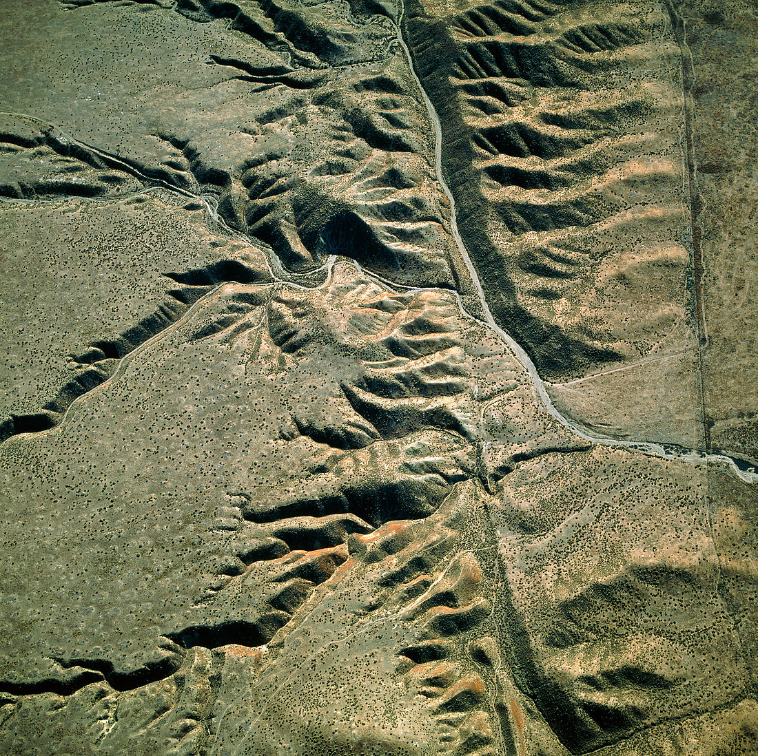
| San Andreas fault. Aerial photograph of the San Andreas fault crossing the Carrizo Plain of California,USA. The San Andreas fault is one of the world's great seismic faults,forming the boundary between the Pacific and North American tectonic plates. It is marked by the valley-like depression running from top to bottom of the picture. Ridges and rifts line either side. This fractured landscape is formed by the pressures created by the opposing,lateral movements of the two tectonic plates. The San Andreas fault extends almost the full length of California and is responsible for major earthquakes | |
| Lizenzart: | Lizenzpflichtig |
| Credit: | Science Photo Library / Edmaier, Bernhard |
| Bildgröße: | 3295 px × 3289 px |
| Modell-Rechte: | nicht erforderlich |
| Eigentums-Rechte: | nicht erforderlich |
| Restrictions: | - |
Preise für dieses Bild ab 15 €
Universitäten & Organisationen
(Informationsmaterial Digital, Informationsmaterial Print, Lehrmaterial Digital etc.)
ab 15 €
Redaktionell
(Bücher, Bücher: Sach- und Fachliteratur, Digitale Medien (redaktionell) etc.)
ab 30 €
Werbung
(Anzeigen, Aussenwerbung, Digitale Medien, Fernsehwerbung, Karten, Werbemittel, Zeitschriften etc.)
ab 55 €
Handelsprodukte
(bedruckte Textilie, Kalender, Postkarte, Grußkarte, Verpackung etc.)
ab 75 €
Pauschalpreise
Rechtepakete für die unbeschränkte Bildnutzung in Print oder Online
ab 495 €