2004 tsunami earthquake intensity map
Bildnummer 11740329
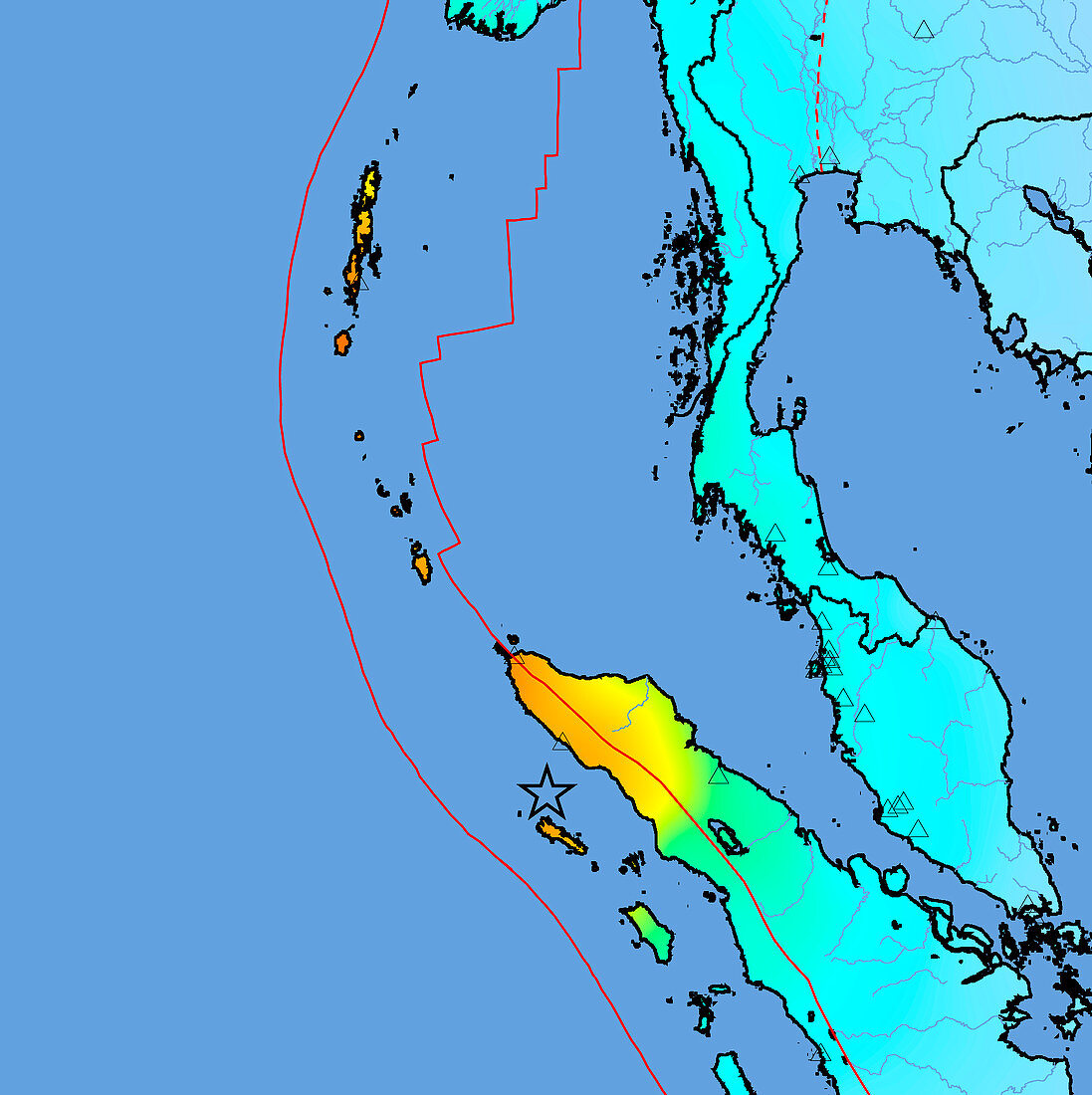
| Asian 2004 tsunami earthquake intensity map. This earthquake,which occurred around 1am GMT on 26th December 2004,had a magnitude of 9 and triggered tsunamis that killed nearly 300,000 people in coastal regions around the Indian Ocean. The epicentre of the earthquake is marked by the star at lower centre,but the displacement that caused the tsunami extended all the way up the fault lines (red). The colours of the land regions show the intensity of the shaking felt,from orange (severe) through yellow (strong) and green (moderate) to blue (weak). The worst affected area was the north tip of the island of Sumatra (running from centre to bottom right). Thailand runs down just right of centre,with part of Malaysia on the same peninsula below it. The Andaman (top left) and Nicobar (centre left) Islands also seen | |
| Lizenzart: | Lizenzpflichtig |
| Credit: | Science Photo Library / US Geological Survey |
| Bildgröße: | 3883 px × 3894 px |
| Modell-Rechte: | nicht erforderlich |
| Eigentums-Rechte: | nicht erforderlich |
| Restrictions: | - |
Preise für dieses Bild ab 15 €
Universitäten & Organisationen
(Informationsmaterial Digital, Informationsmaterial Print, Lehrmaterial Digital etc.)
ab 15 €
Redaktionell
(Bücher, Bücher: Sach- und Fachliteratur, Digitale Medien (redaktionell) etc.)
ab 30 €
Werbung
(Anzeigen, Aussenwerbung, Digitale Medien, Fernsehwerbung, Karten, Werbemittel, Zeitschriften etc.)
ab 55 €
Handelsprodukte
(bedruckte Textilie, Kalender, Postkarte, Grußkarte, Verpackung etc.)
ab 75 €
Pauschalpreise
Rechtepakete für die unbeschränkte Bildnutzung in Print oder Online
ab 495 €