Provence coast,satellite image
Bildnummer 11740013
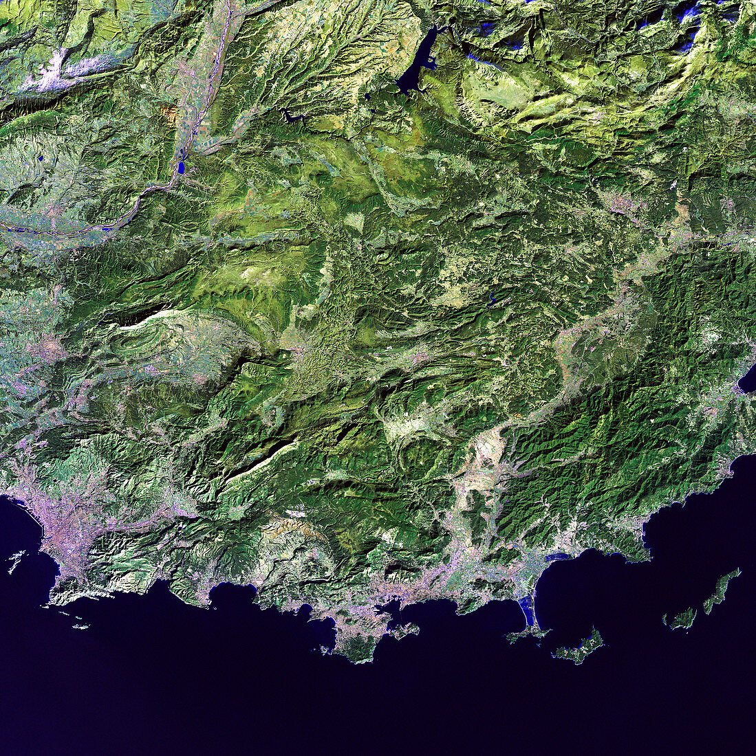
| Provence coast,satellite image. North is at top. Water is dark blue,vegetation is green,and urban areas are pink. Bays and peninsulas form this coastline,where France's Provence region meets the Mediterranean Sea. The large city at lower left is the ancient port of Marseilles,the country's second largest city. Inland,the ridges and peaks of hills alternate with lakes and densely populated river valleys. The area shown in this image is around 100 kilometres wide. The image data includes infrared wavelengths,and was obtained on 1 May 2003,by the Landsat 7 satellite | |
| Lizenzart: | Lizenzpflichtig |
| Credit: | Science Photo Library / NASA |
| Bildgröße: | 4800 px × 4805 px |
| Modell-Rechte: | nicht erforderlich |
| Eigentums-Rechte: | nicht erforderlich |
| Restrictions: | - |
Preise für dieses Bild ab 15 €
Universitäten & Organisationen
(Informationsmaterial Digital, Informationsmaterial Print, Lehrmaterial Digital etc.)
ab 15 €
Redaktionell
(Bücher, Bücher: Sach- und Fachliteratur, Digitale Medien (redaktionell) etc.)
ab 30 €
Werbung
(Anzeigen, Aussenwerbung, Digitale Medien, Fernsehwerbung, Karten, Werbemittel, Zeitschriften etc.)
ab 55 €
Handelsprodukte
(bedruckte Textilie, Kalender, Postkarte, Grußkarte, Verpackung etc.)
ab 75 €
Pauschalpreise
Rechtepakete für die unbeschränkte Bildnutzung in Print oder Online
ab 495 €
Keywords
- 2000er Jahre,
- 21. Jahrhundert,
- Blütezeit,
- Erdbeobachtung,
- Erdkunde,
- Europa,
- europäisch,
- Felder,
- Frankreich,
- Französisch,
- Frühling,
- geografisch,
- Geographie,
- Geologie,
- geologisch,
- Hafen,
- Hagedorn,
- infrarot,
- ir,
- Küste,
- Küsten-,
- Küstenlinie,
- Land,
- Landsat 7,
- Marine,
- Marseille,
- Meer,
- Mittelmeer,
- Natur,
- Provence,
- Region,
- Satellit,
- Satellitenbild,
- Stadt,
- städtisch,
- Umwelt,
- Vegetation,
- Wasser,
- Weltall