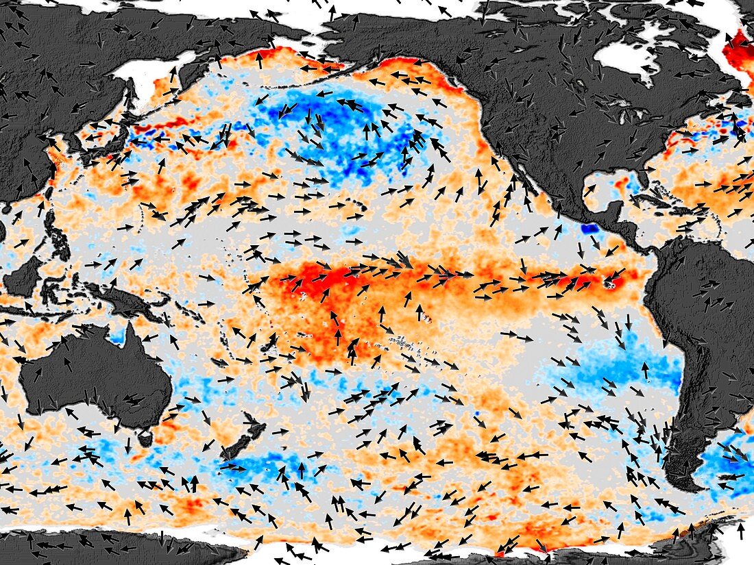
El Nino sea temperatures
Bildnummer 11739669

| 2002-3 El Nino . Satellite data on anomalies in sea surface temperature (SST) and the direction of the wind in the Pacific Ocean. Land is grey. The SST data shows areas that are hotter (orange) and cooler (blue) than normal. Wind direction is shown by the arrows. The El Nino weather cycle is caused by the warm equatorial sea current seen in the Pacific. This is a mild El Nino,where the warmer area is mostly in mid-Pacific,rather than close to the South American coast. A strong El Nino can cause unseasonal storms and droughts. SST data from the Advanced Microwave Radiometer (AMSR) on the Aqua satellite. Wind data from the QuikSCAT science team | |
| Lizenzart: | Lizenzpflichtig |
| Credit: | Science Photo Library / NASA |
| Bildgröße: | 2560 px × 1920 px |
| Modell-Rechte: | nicht erforderlich |
| Eigentums-Rechte: | nicht erforderlich |
| Restrictions: | - |
Preise für dieses Bild ab 15 €
Universitäten & Organisationen
(Informationsmaterial Digital, Informationsmaterial Print, Lehrmaterial Digital etc.)
ab 15 €
Redaktionell
(Bücher, Bücher: Sach- und Fachliteratur, Digitale Medien (redaktionell) etc.)
ab 30 €
Werbung
(Anzeigen, Aussenwerbung, Digitale Medien, Fernsehwerbung, Karten, Werbemittel, Zeitschriften etc.)
ab 55 €
Handelsprodukte
(bedruckte Textilie, Kalender, Postkarte, Grußkarte, Verpackung etc.)
ab 75 €
Pauschalpreise
Rechtepakete für die unbeschränkte Bildnutzung in Print oder Online
ab 495 €
