AVHRR image of Hurricane Bob off US east coast
Bildnummer 11737942
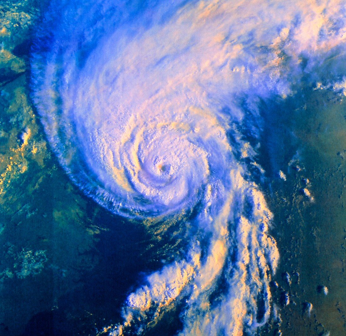
| Hurricane Bob. False-colour satellite image of the swirling clouds of Hurricane Bob approaching the east coast of the USA on 19 August 1991. The 'eye' of the hurricane is at centre. The green area toward bottom left is the coast of Virginia and North Carolina. The deep blue area at top left is Lake Erie. Hurricanes are cyclonic storms,in which the wind speed may reach 200 kilometres per hour. They also have a central 'eye',where there are clear,calm conditions. Hurricanes originate in ocean areas about 5 degrees from the equator where the surface temperature is over 27 degrees Celsius. The data for this image were gathered by an AVHRR radiometer on the NOAA-11 satellite | |
| Lizenzart: | Lizenzpflichtig |
| Credit: | Science Photo Library / NOAA |
| Bildgröße: | 4469 px × 4351 px |
| Modell-Rechte: | nicht erforderlich |
| Eigentums-Rechte: | nicht erforderlich |
| Restrictions: |
|
Preise für dieses Bild ab 15 €
Universitäten & Organisationen
(Informationsmaterial Digital, Informationsmaterial Print, Lehrmaterial Digital etc.)
ab 15 €
Redaktionell
(Bücher, Bücher: Sach- und Fachliteratur, Digitale Medien (redaktionell) etc.)
ab 30 €
Werbung
(Anzeigen, Aussenwerbung, Digitale Medien, Fernsehwerbung, Karten, Werbemittel, Zeitschriften etc.)
ab 55 €
Handelsprodukte
(bedruckte Textilie, Kalender, Postkarte, Grußkarte, Verpackung etc.)
ab 75 €
Pauschalpreise
Rechtepakete für die unbeschränkte Bildnutzung in Print oder Online
ab 495 €