False-col weather satellite pic of Hurricane Allen
Bildnummer 11737931
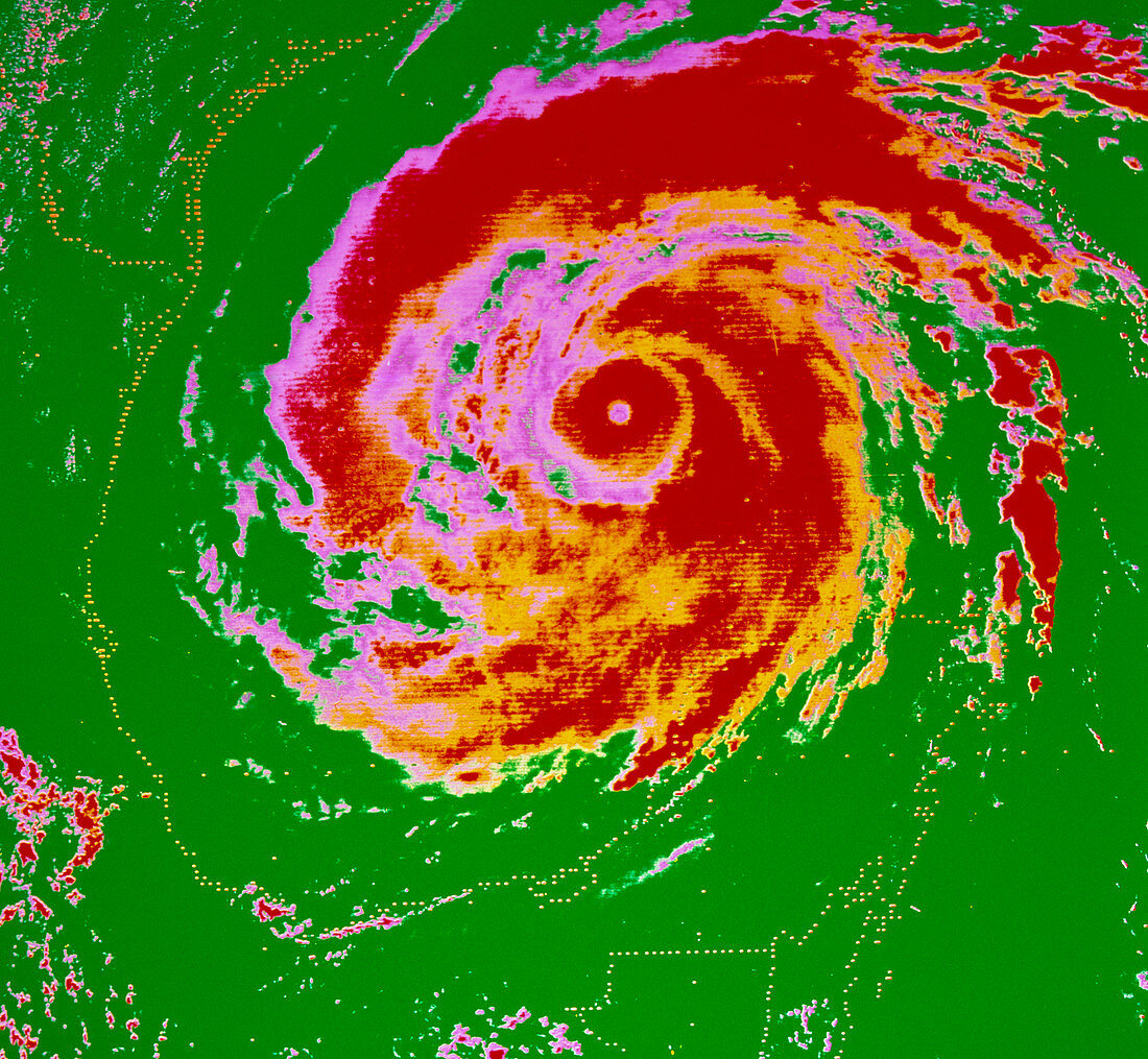
| False-colour weather satellite photograph of Hurricane Allen over the Gulf of Mexico on August 8,1980. The dotted yellow lines show the coast of the United States,Mexico,& Gautemala,with the borders between them also marked. The picture was taken by GOES,the Geostationary Operational Environmental Satellite,which is operated by the US National Oceanic & Atmospheric Administration (NOAA). Rossdale colouring of BW print E155/011 | |
| Lizenzart: | Lizenzpflichtig |
| Credit: | Science Photo Library / NOAA |
| Bildgröße: | 4606 px × 4249 px |
| Modell-Rechte: | nicht erforderlich |
| Eigentums-Rechte: | nicht erforderlich |
| Restrictions: | - |
Preise für dieses Bild ab 15 €
Universitäten & Organisationen
(Informationsmaterial Digital, Informationsmaterial Print, Lehrmaterial Digital etc.)
ab 15 €
Redaktionell
(Bücher, Bücher: Sach- und Fachliteratur, Digitale Medien (redaktionell) etc.)
ab 30 €
Werbung
(Anzeigen, Aussenwerbung, Digitale Medien, Fernsehwerbung, Karten, Werbemittel, Zeitschriften etc.)
ab 55 €
Handelsprodukte
(bedruckte Textilie, Kalender, Postkarte, Grußkarte, Verpackung etc.)
ab 75 €
Pauschalpreise
Rechtepakete für die unbeschränkte Bildnutzung in Print oder Online
ab 495 €