Iraq and neighbouring countries
Bildnummer 11735853
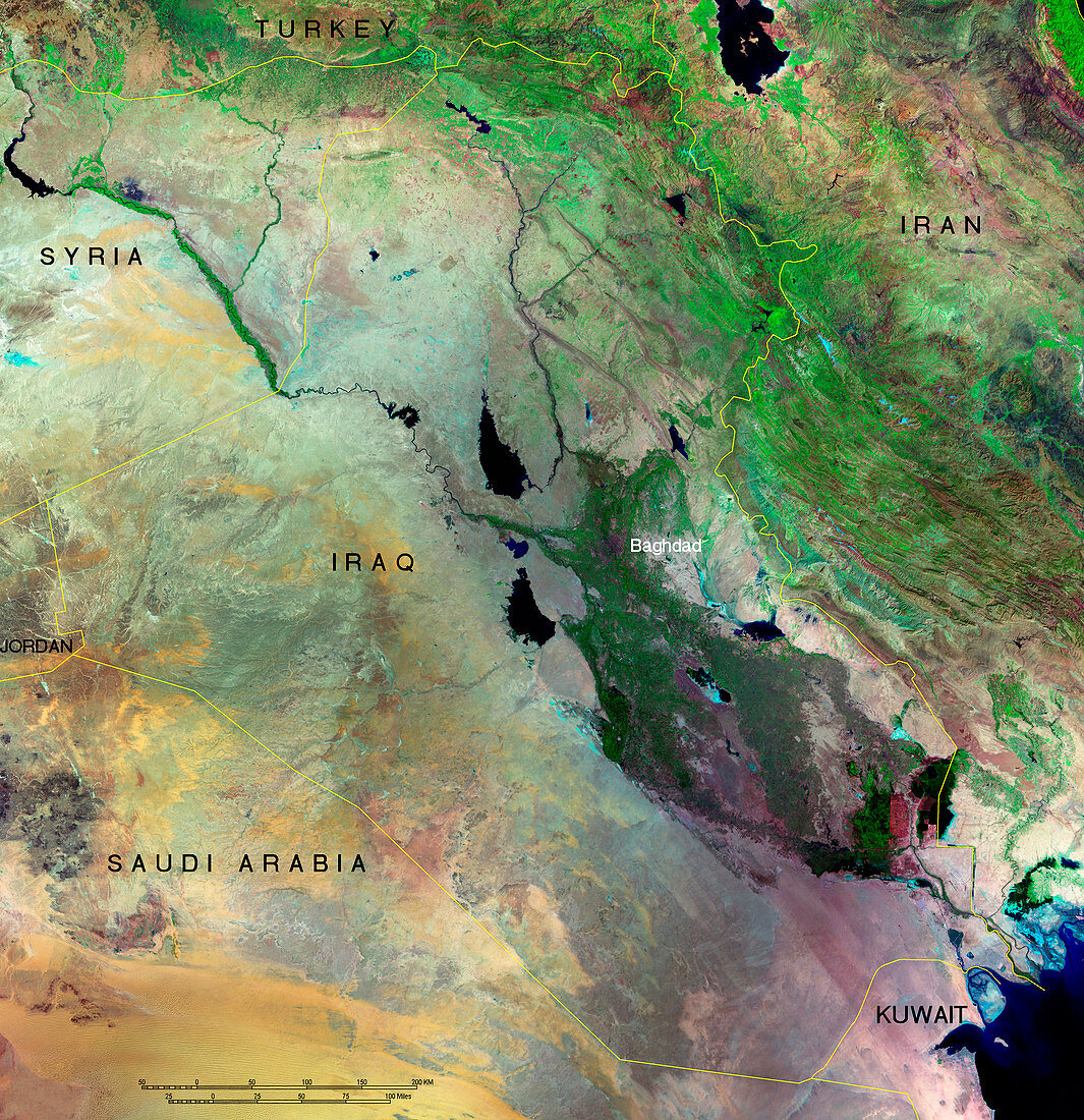
| Iraq and neighbouring countries,composite satellite image with country names and borders superimposed. Iraq's capital city,Baghdad,is also marked (to left of text label). North is at top. The rivers Tigris (upper centre,between Turkey and Baghdad) and Euphrates (upper/centre left,crossing Syrian border) are seen. At lower right,the Shatt al Arab river flows into the Persian Gulf. Iraq has a total area of 437,072 square kilometres. Most of its land area is desert (yellow/grey),with reedy marshes (green/red) in the south-east | |
| Lizenzart: | Lizenzpflichtig |
| Credit: | Science Photo Library / MDA Information Systems |
| Bildgröße: | 6914 px × 7142 px |
| Modell-Rechte: | nicht erforderlich |
| Eigentums-Rechte: | nicht erforderlich |
| Restrictions: | - |
Preise für dieses Bild ab 15 €
Universitäten & Organisationen
(Informationsmaterial Digital, Informationsmaterial Print, Lehrmaterial Digital etc.)
ab 15 €
Redaktionell
(Bücher, Bücher: Sach- und Fachliteratur, Digitale Medien (redaktionell) etc.)
ab 30 €
Werbung
(Anzeigen, Aussenwerbung, Digitale Medien, Fernsehwerbung, Karten, Werbemittel, Zeitschriften etc.)
ab 55 €
Handelsprodukte
(bedruckte Textilie, Kalender, Postkarte, Grußkarte, Verpackung etc.)
ab 75 €
Pauschalpreise
Rechtepakete für die unbeschränkte Bildnutzung in Print oder Online
ab 495 €
Keywords
- Arabisch,
- Asien,
- Bild,
- Bilder,
- Bilderwelt,
- Erdbeobachtung,
- Erdkunde,
- Fluss,
- Flüsse,
- Foto,
- Fotos,
- geografisch,
- Geographie,
- Grenzen,
- Hauptstadt,
- Irak,
- Iran,
- iranisch,
- Jordanien,
- Karte,
- Kuwait,
- Land,
- Länder,
- Mittlerer Osten,
- Mosaik-,
- Nachbarn,
- Nation,
- Nationen,
- Persisch,
- politisch,
- Rand,
- Region,
- Satellitenbild,
- Saudi Arabien,
- Stadt,
- Städte,
- Sumpf,
- Syrien,
- Syrisch,
- Truthahn,
- Türkisch,
- Weltall,
- Wissenschaften,
- Wüste,
- Zusammengesetzt