Thailand
Bildnummer 11735841
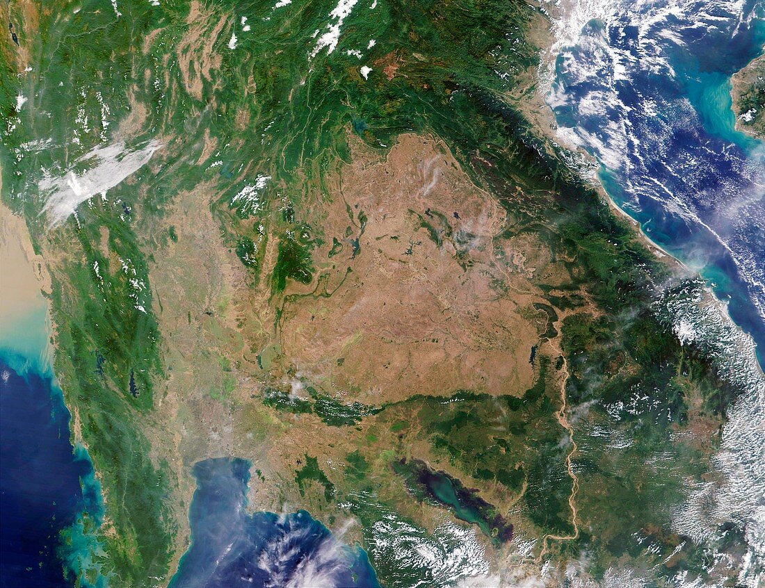
| Thailand & surrounding countries,satellite image. North is at top. Land is brown,water is blue,vegetation is green and clouds are white. The Gulf of Tonkin (top right corner),the Gulf of Martaban (bottom left corner) and to the right of this the Malay Peninsula are seen. The upper part of the Gulf of Martaban contains sediment (light brown) brought by the Salween River (not seen). The Tonle Sap lake (lower centre) is the largest freshwater lake in Asia,this is its wintertime extent of 3000 square kilometres (km). In the rainy season it grows to 7500 square km. Photographed by the Moderate Resolution Imaging Spectroradiometer (MODIS) on board NASA's Terra satellite | |
| Lizenzart: | Lizenzpflichtig |
| Credit: | Science Photo Library / NASA |
| Bildgröße: | 5200 px × 4000 px |
| Modell-Rechte: | nicht erforderlich |
| Eigentums-Rechte: | nicht erforderlich |
| Restrictions: | - |
Preise für dieses Bild ab 15 €
Universitäten & Organisationen
(Informationsmaterial Digital, Informationsmaterial Print, Lehrmaterial Digital etc.)
ab 15 €
Redaktionell
(Bücher, Bücher: Sach- und Fachliteratur, Digitale Medien (redaktionell) etc.)
ab 30 €
Werbung
(Anzeigen, Aussenwerbung, Digitale Medien, Fernsehwerbung, Karten, Werbemittel, Zeitschriften etc.)
ab 55 €
Handelsprodukte
(bedruckte Textilie, Kalender, Postkarte, Grußkarte, Verpackung etc.)
ab 75 €
Pauschalpreise
Rechtepakete für die unbeschränkte Bildnutzung in Print oder Online
ab 495 €
Keywords
- Asiatisch,
- Bild,
- Bilder,
- Birma,
- Erdkunde,
- Foto,
- Fotos,
- Geographie,
- Kambodscha,
- Kontinent,
- Laos,
- Malaiische Halbinsel,
- modis,
- Myanmar,
- NASA,
- November,
- See,
- Südostasien,
- Terra,
- Thailand,
- Vietnam,
- Weltall,
- Wissenschaften