East Indies,17th century
Bildnummer 11730650
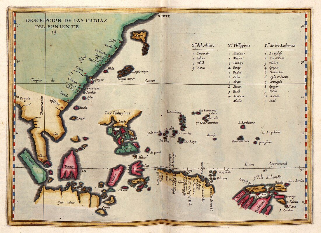
| East Indies. 17th-century map of the East Indies and the islands of South-East Asia. The East Indies were the lands discovered by European explorers travelling east to the lands beyond India and China. Islands listed at upper right are the Moluccas,the Philippines,and the Ladrones (Mariana Islands). Other places include Sumatra,Java,Borneo,Japan,the Celebes,New Guinea and the Solomon Islands. This map is from 'Descriptio Indiae Occidentale' in 'Nieuwe werelt' (1622),a Dutch republication of an earlier 1601 work by Spanish historian Antonio de Herrera y Tordesillas (1549-1626). This Dutch edition was published in Amsterdam by Michiel Colijn | |
| Lizenzart: | Lizenzpflichtig |
| Credit: | Science Photo Library / LIBRARY OF CONGRESS, Geography and Map Division |
| Bildgröße: | 4914 px × 3567 px |
| Modell-Rechte: | nicht erforderlich |
| Eigentums-Rechte: | nicht erforderlich |
| Restrictions: | - |
Preise für dieses Bild ab 15 €
Universitäten & Organisationen
(Informationsmaterial Digital, Informationsmaterial Print, Lehrmaterial Digital etc.)
ab 15 €
Redaktionell
(Bücher, Bücher: Sach- und Fachliteratur, Digitale Medien (redaktionell) etc.)
ab 30 €
Werbung
(Anzeigen, Aussenwerbung, Digitale Medien, Fernsehwerbung, Karten, Werbemittel, Zeitschriften etc.)
ab 55 €
Handelsprodukte
(bedruckte Textilie, Kalender, Postkarte, Grußkarte, Verpackung etc.)
ab 75 €
Pauschalpreise
Rechtepakete für die unbeschränkte Bildnutzung in Print oder Online
ab 495 €
Keywords
- 1600er Jahre,
- 17. Jahrhundert,
- Äquator,
- Asiatisch,
- Asien,
- Atlas,
- China,
- Diagramm,
- geografisch,
- Geographie,
- Geschichte,
- historisch,
- Illustration,
- Indonesien,
- Insel,
- Inseln,
- Japan,
- Java,
- Kanton,
- Karte,
- Kartographie,
- Kunstwerk,
- Malaiischer Archipel,
- Malaysia,
- Neue Welt,
- Niederländisch,
- Niemand,
- Philippinen,
- Region,
- spanisch,
- Südostasien,
- Sumatra,
- Veröffentlichung