World map,1803 Turkish atlas
Bildnummer 11730634
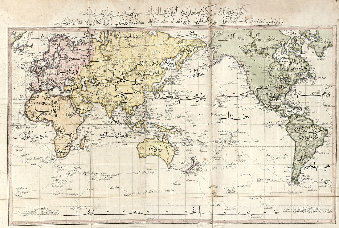
| World map. Early 19th-century map of the world with labels in Ottoman Turkish. The colour scheme divides the world into four continents: Europe (pink),Africa (orange),Asia (yellow),and the Americas (green). This map is from 'Cedid atlas tercumesi' (1803),an atlas produced by Tab'hane-yi Humayun and published in Istanbul,Turkey,during the period of the Ottoman Empire. The maps were based on those made by British cartographer William Faden (1749-1836) for his General atlas | |
| Lizenzart: | Lizenzpflichtig |
| Credit: | Science Photo Library / LIBRARY OF CONGRESS, Geography and Map Division |
| Bildgröße: | 5604 px × 3768 px |
| Modell-Rechte: | nicht erforderlich |
| Eigentums-Rechte: | nicht erforderlich |
| Restrictions: | - |
Preise für dieses Bild ab 15 €
Universitäten & Organisationen
(Informationsmaterial Digital, Informationsmaterial Print, Lehrmaterial Digital etc.)
ab 15 €
Redaktionell
(Bücher, Bücher: Sach- und Fachliteratur, Digitale Medien (redaktionell) etc.)
ab 30 €
Werbung
(Anzeigen, Aussenwerbung, Digitale Medien, Fernsehwerbung, Karten, Werbemittel, Zeitschriften etc.)
ab 55 €
Handelsprodukte
(bedruckte Textilie, Kalender, Postkarte, Grußkarte, Verpackung etc.)
ab 75 €
Pauschalpreise
Rechtepakete für die unbeschränkte Bildnutzung in Print oder Online
ab 495 €
Keywords
- 1800er Jahre,
- 19. Jahrhundert,
- Afrika,
- Afrikanisch,
- Asiatisch,
- Asien,
- Atlas,
- Diagramm,
- Erde,
- Europa,
- europäisch,
- farbcodiert,
- geografisch,
- Geographie,
- Geschichte,
- historisch,
- Illustration,
- Karte,
- Kartographie,
- Kontinent,
- Kontinente,
- Kunstwerk,
- Lateinamerika,
- Niemand,
- Nordamerika,
- nordamerikanisch,
- Ottomane,
- Planet,
- planetarisch,
- Südamerika,
- Südamerikanisch,
- Türkisch,
- Veröffentlichung,
- Welt,
- Weltkarte,
- weltweit,
- William Faden