Gamburtsev Subglacial Mountains
Bildnummer 11728154
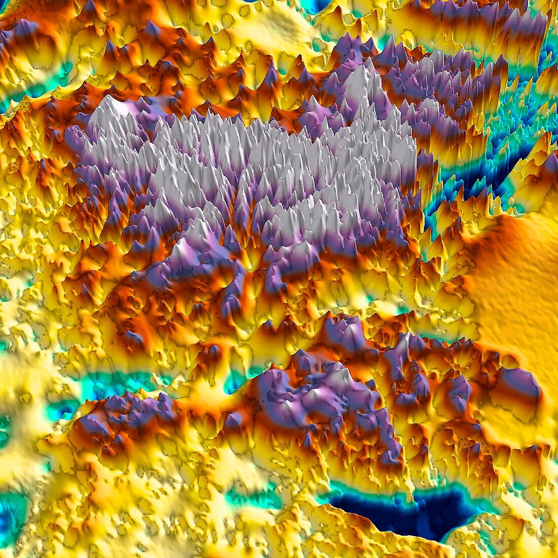
| Radar image of the Gamburtsev Subglacial Mountains in the East Antarctic. This mountain range is believed to be approximately 2,700 metres tall,but is entirely covered by over 600 metres of snow and ice. The range first formed over a billion years ago when several continents collided,but wasn't covered until the East Antarctic Ice Sheet formed 34 million years ago. Between those times glaciers carved deep valleys in the landscape. Data collected by ice-penetrating airborne radar on Twin Otter aircraft from the British Antarctic Survey and the US Antarctic Program between December 2008 and January 2009 | |
| Lizenzart: | Lizenzpflichtig |
| Credit: | Science Photo Library / Pete Bucktrout, BRITISH ANTARCTIC SURVEY / Tom Jordan |
| Bildgröße: | 4594 px × 4594 px |
| Modell-Rechte: | nicht erforderlich |
| Eigentums-Rechte: | nicht erforderlich |
| Restrictions: | - |
Preise für dieses Bild ab 15 €
Universitäten & Organisationen
(Informationsmaterial Digital, Informationsmaterial Print, Lehrmaterial Digital etc.)
ab 15 €
Redaktionell
(Bücher, Bücher: Sach- und Fachliteratur, Digitale Medien (redaktionell) etc.)
ab 30 €
Werbung
(Anzeigen, Aussenwerbung, Digitale Medien, Fernsehwerbung, Karten, Werbemittel, Zeitschriften etc.)
ab 55 €
Handelsprodukte
(bedruckte Textilie, Kalender, Postkarte, Grußkarte, Verpackung etc.)
ab 75 €
Pauschalpreise
Rechtepakete für die unbeschränkte Bildnutzung in Print oder Online
ab 495 €