Osuga Valles,Mars,satellite image
Bildnummer 11716827
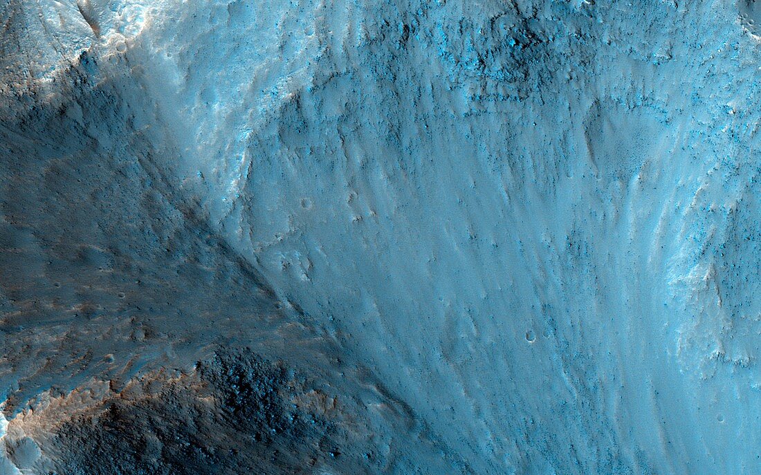
| Osuga Valles,Mars. Satellite image of the lowest point of the Osuga Valles region on the surface of Mars. Osuga Valles lies around 170 kilometres to the south of Eos Chasma,at the eastern end of the vast Valles Marineris canyon system. This region is an outflow area,probably the result of ancient and catastrophic flooding. This image shows part of a deep pit at the end of the valley,filled with small hills. Imaged by the High Resolution Imaging Science Experiment (HiRISE) camera on NASA's Mars Reconnaissance Orbiter (MRO) satellite | |
| Lizenzart: | Lizenzpflichtig |
| Credit: | Science Photo Library / NASA / JPL / University of Arizona |
| Bildgröße: | 3749 px × 2343 px |
| Modell-Rechte: | nicht erforderlich |
| Eigentums-Rechte: | nicht erforderlich |
| Restrictions: | - |
Preise für dieses Bild ab 15 €
Universitäten & Organisationen
(Informationsmaterial Digital, Informationsmaterial Print, Lehrmaterial Digital etc.)
ab 15 €
Redaktionell
(Bücher, Bücher: Sach- und Fachliteratur, Digitale Medien (redaktionell) etc.)
ab 30 €
Werbung
(Anzeigen, Aussenwerbung, Digitale Medien, Fernsehwerbung, Karten, Werbemittel, Zeitschriften etc.)
ab 55 €
Handelsprodukte
(bedruckte Textilie, Kalender, Postkarte, Grußkarte, Verpackung etc.)
ab 75 €
Pauschalpreise
Rechtepakete für die unbeschränkte Bildnutzung in Print oder Online
ab 495 €
Keywords
- Astrogeologie,
- astrogeologisch,
- Astronomie,
- astronomisch,
- Close-up,
- Detail,
- erodiert,
- Erosion,
- Fluss,
- Flut,
- Formationen,
- geografisch,
- Geographie,
- Geologie,
- geologisch,
- Geomorphologie,
- Grube,
- HiRISE,
- Hügel,
- Hügelig,
- Mars,
- MRO,
- Niemand,
- Planetenwissenschaft,
- Region,
- Satellit,
- Satellitenbild,
- Sonnensystem,
- Überschwemmung,
- Valles Marineris,
- vom Mars,
- Wasser,
- Weltall,
- Weltraumbeobachtung