Sinabung volcanic eruption,February 2014
Bildnummer 11701560
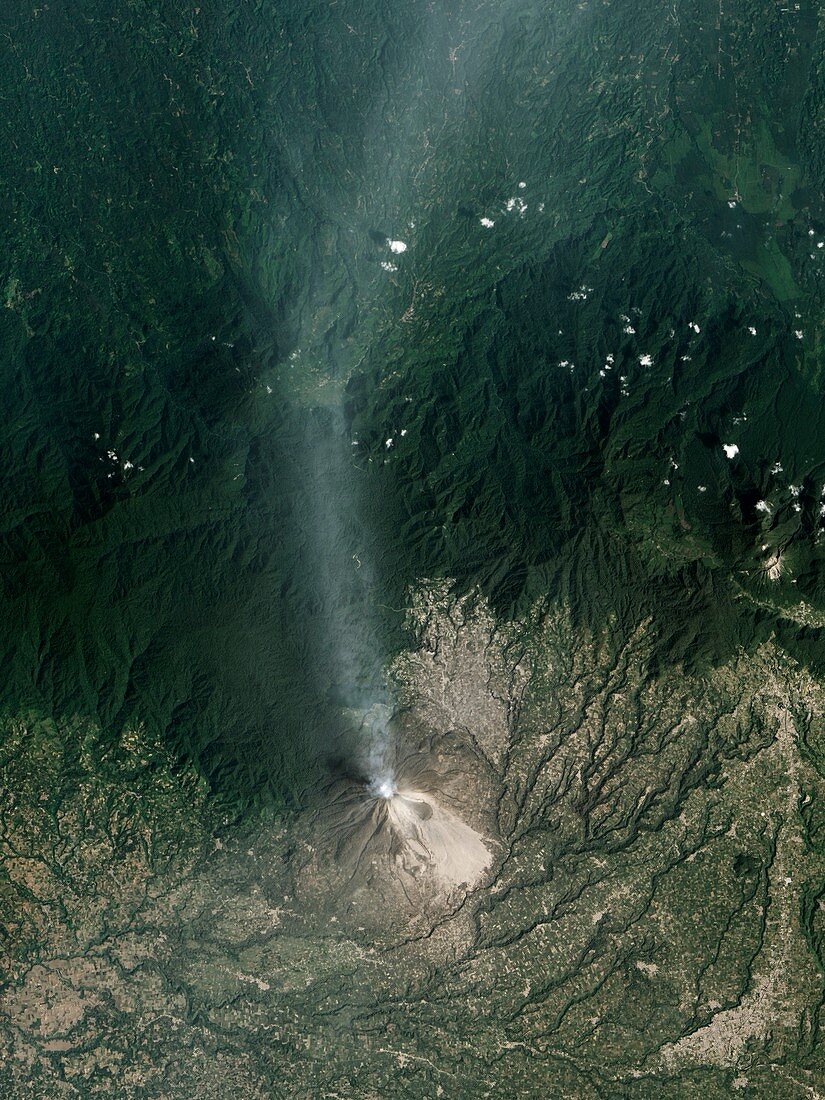
| Sinabung volcanic eruption. Satellite image of the February 2014 ash plume from the Mount Sinabung volcano in North Sumatra,Indonesia. North is at top. Frequent collapses from the unstable lava dome near Sinabung's summit created pyroclastic flows that swept some 4.5 kilometres down the slopes. The flow deposits (light grey) are visible south-east of Sinabung's summit. The ash plume is being blown northwards. The eruption has coated much of the surrounding landscape with ash,causing dark green forests to appear tan. This image was obtained on 6 February 2014 by the Advanced Land Imager (ALI) on NASA's Earth Observing-1 (EO-1) satellite | |
| Lizenzart: | Lizenzpflichtig |
| Credit: | Science Photo Library / NASA Earth Observatory |
| Bildgröße: | 3621 px × 4828 px |
| Modell-Rechte: | nicht erforderlich |
| Eigentums-Rechte: | nicht erforderlich |
| Restrictions: | - |
Preise für dieses Bild ab 15 €
Universitäten & Organisationen
(Informationsmaterial Digital, Informationsmaterial Print, Lehrmaterial Digital etc.)
ab 15 €
Redaktionell
(Bücher, Bücher: Sach- und Fachliteratur, Digitale Medien (redaktionell) etc.)
ab 30 €
Werbung
(Anzeigen, Aussenwerbung, Digitale Medien, Fernsehwerbung, Karten, Werbemittel, Zeitschriften etc.)
ab 55 €
Handelsprodukte
(bedruckte Textilie, Kalender, Postkarte, Grußkarte, Verpackung etc.)
ab 75 €
Pauschalpreise
Rechtepakete für die unbeschränkte Bildnutzung in Print oder Online
ab 495 €