Virunga Mountains,satellite image
Bildnummer 11698887
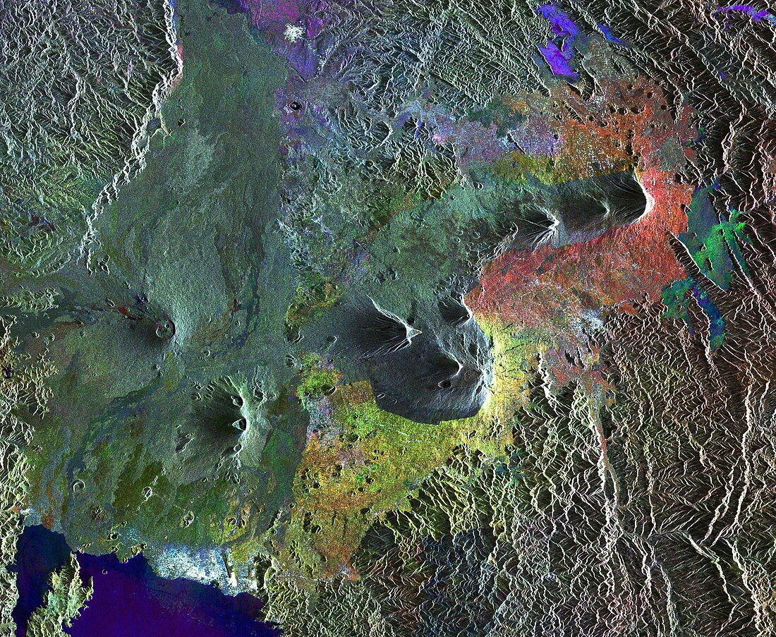
| Virunga Mountains,satellite image. North is at top. The mountain peaks are volcanoes near Rwanda's northern border with Uganda. They are Nyamuragira (upper centre),Nyiragongo (lower left),Karisimbi (centre) and Muhabura (upper right). The area pictured is part of the Albertine Rift,one of Africa's most biologically diverse regions. On the shores of Lake Kivu (lower left) is the city of Goma (white). This image is a compilation of three images from the radar sensor of the Envisat satellite,acquired on 27 March 2003,5 January 2006 and 12 August 2010. The images are assigned a colour (red,green and blue) and combined to reveal changes in the surface | |
| Lizenzart: | Lizenzpflichtig |
| Credit: | Science Photo Library / ESA |
| Bildgröße: | 7015 px × 5760 px |
| Modell-Rechte: | nicht erforderlich |
| Eigentums-Rechte: | nicht erforderlich |
| Restrictions: |
|
Preise für dieses Bild ab 15 €
Universitäten & Organisationen
(Informationsmaterial Digital, Informationsmaterial Print, Lehrmaterial Digital etc.)
ab 15 €
Redaktionell
(Bücher, Bücher: Sach- und Fachliteratur, Digitale Medien (redaktionell) etc.)
ab 30 €
Werbung
(Anzeigen, Aussenwerbung, Digitale Medien, Fernsehwerbung, Karten, Werbemittel, Zeitschriften etc.)
ab 55 €
Handelsprodukte
(bedruckte Textilie, Kalender, Postkarte, Grußkarte, Verpackung etc.)
ab 75 €
Pauschalpreise
Rechtepakete für die unbeschränkte Bildnutzung in Print oder Online
ab 495 €
Keywords
- 2010,
- 21. Jahrhundert,
- Afrika,
- Afrikanisch,
- Albertine Rift,
- Berg,
- Berge,
- Erdbeobachtung,
- geografisch,
- Geographie,
- Geologie,
- geologisch,
- Natur,
- Niemand,
- Ökologie,
- Ökologisch,
- Regenwald,
- Satellit,
- Satellitenbild,
- Stadt,
- Uganda,
- ugandisch,
- Umwelt,
- Vielfältig,
- Vulkan,
- Vulkane,
- Wald,
- Wälder,
- Weltall,
- Zusammengesetzt