Map of the Himalayas,national boundaries
Bildnummer 11677021
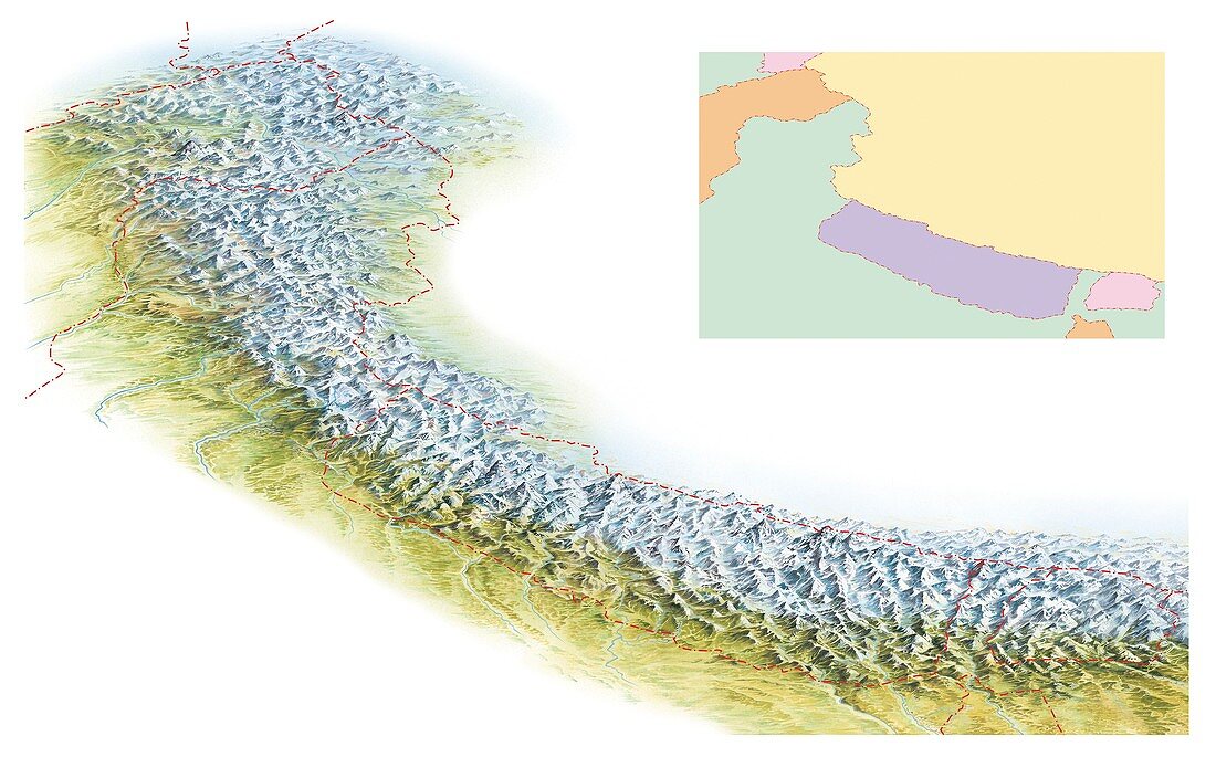
| Map of the Himalayas. National boundaries (red dotted lines) on a relief map of of the Himalayan mountain ranges in Asia. The colour-coded inset shows the countries of the region. Most of the Himalayan mountains lie within Nepal (purple),India (green) and Bhutan (pink,lower right). Three of the highest (including Everest) lie on the border between Nepal and China (yellow,see C019/9304). Other countries partially shown include Bangladesh (orange,lower right),Pakistan (orange,upper left),Afghanistan (green,top left),and Tajikistan (pink,top left). The area shown here is around 2400 kilometres long,with part of the Karakoram range at top left | |
| Lizenzart: | Lizenzpflichtig |
| Credit: | Science Photo Library / Hks, Gary |
| Bildgröße: | 5332 px × 3319 px |
| Modell-Rechte: | nicht erforderlich |
| Eigentums-Rechte: | nicht erforderlich |
| Restrictions: | - |
Preise für dieses Bild ab 15 €
Universitäten & Organisationen
(Informationsmaterial Digital, Informationsmaterial Print, Lehrmaterial Digital etc.)
ab 15 €
Redaktionell
(Bücher, Bücher: Sach- und Fachliteratur, Digitale Medien (redaktionell) etc.)
ab 30 €
Werbung
(Anzeigen, Aussenwerbung, Digitale Medien, Fernsehwerbung, Karten, Werbemittel, Zeitschriften etc.)
ab 55 €
Handelsprodukte
(bedruckte Textilie, Kalender, Postkarte, Grußkarte, Verpackung etc.)
ab 75 €
Pauschalpreise
Rechtepakete für die unbeschränkte Bildnutzung in Print oder Online
ab 495 €
Keywords
- 1,
- Afghanistan,
- Asiatisch,
- Asien,
- Berge,
- Bergkette,
- Bhutan,
- China,
- Eis,
- Erdkunde,
- Flüsse,
- geografisch,
- Geographie,
- Geologie,
- geologisch,
- Geowissenschaften,
- Grenze,
- Grenzen,
- Himalaya,
- Illustration,
- Indien,
- Indisch,
- Karte,
- Kunstwerk,
- Land,
- Länder,
- Linderung,
- Nation,
- Nationen,
- Nepal,
- Pakistan,
- Politik,
- politisch,
- Schnee,
- Schneebedeckt,
- Staat,
- Tadschikistan,
- weißer Hintergrund