Cretaceous world map,artwork
Bildnummer 11658833
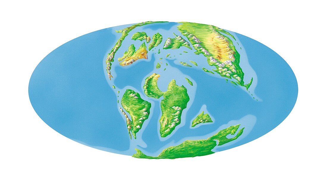
| Cretaceous world map. Elliptical projection of the Earth's continents as they appeared during the Cretaceous Period (145 to 65 million years ago). The alignment of the continents shown here dates to around 65 million years ago,the extinction of the dinosaurs. The continents as we know them today are beginning to form,following the break up of the supercontinent of Pangea that existed from 300 to 200 million years ago. For the break up of Pangea and world maps for the Triassic,Jurassic and Cretaceous periods,see images C018/0196 to C018/0199 | |
| Lizenzart: | Lizenzpflichtig |
| Credit: | Science Photo Library / Hks, Gary |
| Bildgröße: | 5564 px × 3154 px |
| Modell-Rechte: | nicht erforderlich |
| Eigentums-Rechte: | nicht erforderlich |
| Restrictions: | - |
Preise für dieses Bild ab 15 €
Universitäten & Organisationen
(Informationsmaterial Digital, Informationsmaterial Print, Lehrmaterial Digital etc.)
ab 15 €
Redaktionell
(Bücher, Bücher: Sach- und Fachliteratur, Digitale Medien (redaktionell) etc.)
ab 30 €
Werbung
(Anzeigen, Aussenwerbung, Digitale Medien, Fernsehwerbung, Karten, Werbemittel, Zeitschriften etc.)
ab 55 €
Handelsprodukte
(bedruckte Textilie, Kalender, Postkarte, Grußkarte, Verpackung etc.)
ab 75 €
Pauschalpreise
Rechtepakete für die unbeschränkte Bildnutzung in Print oder Online
ab 495 €