Atlantic hurricanes,August 2010
Bildnummer 11649060
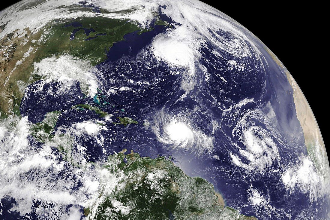
| Atlantic hurricanes. Earth globe satellite image showing hurricanes developing in the Atlantic in August 2010. North is at top. The Americas are at left,with the eastern coast of Africa just visible at far right. In the northern Atlantic inbetween,two hurricanes are seen: Hurricane Danielle (upper centre) and Hurricane Earl (lower centre,near the Leeward Islands). A developing tropical depression (lower right) later became Tropical Storm Fiona. Image data obtained by the GOES-13 (Geostationary Operational Environmental Satellite-13) at 14:45 UTC on 29 August 2010 | |
| Lizenzart: | Lizenzpflichtig |
| Credit: | Science Photo Library / Goes Project / NASA / NOAA |
| Bildgröße: | 5132 px × 3415 px |
| Modell-Rechte: | nicht erforderlich |
| Eigentums-Rechte: | nicht erforderlich |
| Restrictions: | - |
Preise für dieses Bild ab 15 €
Universitäten & Organisationen
(Informationsmaterial Digital, Informationsmaterial Print, Lehrmaterial Digital etc.)
ab 15 €
Redaktionell
(Bücher, Bücher: Sach- und Fachliteratur, Digitale Medien (redaktionell) etc.)
ab 30 €
Werbung
(Anzeigen, Aussenwerbung, Digitale Medien, Fernsehwerbung, Karten, Werbemittel, Zeitschriften etc.)
ab 55 €
Handelsprodukte
(bedruckte Textilie, Kalender, Postkarte, Grußkarte, Verpackung etc.)
ab 75 €
Pauschalpreise
Rechtepakete für die unbeschränkte Bildnutzung in Print oder Online
ab 495 €