North Africa and Europe,satellite image
Bildnummer 11649054
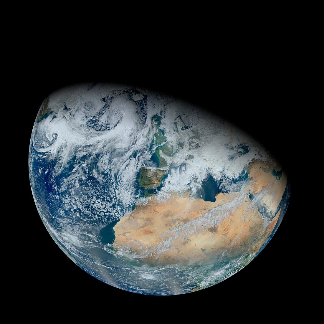
| North Africa and Europe,satellite image. North is towards top. Clouds (white) are seen over most of Europe,with a cloud-free view over the vast expanse of the Sahara (brown) in North Africa. Image data obtained on 3 February 2012 by the Visible Infrared Imaging Radiometer Suite (VIIRS) instrument,soon after its launch on the Suomi NPP (Suomi National Polar-orbiting Partnership) satellite | |
| Lizenzart: | Lizenzpflichtig |
| Credit: | Science Photo Library / Kuring, Norman / NASA / GSFC |
| Bildgröße: | 4205 px × 4205 px |
| Modell-Rechte: | nicht erforderlich |
| Eigentums-Rechte: | nicht erforderlich |
| Restrictions: | - |
Preise für dieses Bild ab 15 €
Universitäten & Organisationen
(Informationsmaterial Digital, Informationsmaterial Print, Lehrmaterial Digital etc.)
ab 15 €
Redaktionell
(Bücher, Bücher: Sach- und Fachliteratur, Digitale Medien (redaktionell) etc.)
ab 30 €
Werbung
(Anzeigen, Aussenwerbung, Digitale Medien, Fernsehwerbung, Karten, Werbemittel, Zeitschriften etc.)
ab 55 €
Handelsprodukte
(bedruckte Textilie, Kalender, Postkarte, Grußkarte, Verpackung etc.)
ab 75 €
Pauschalpreise
Rechtepakete für die unbeschränkte Bildnutzung in Print oder Online
ab 495 €