Middle East at night,satellite image
Bildnummer 11639809
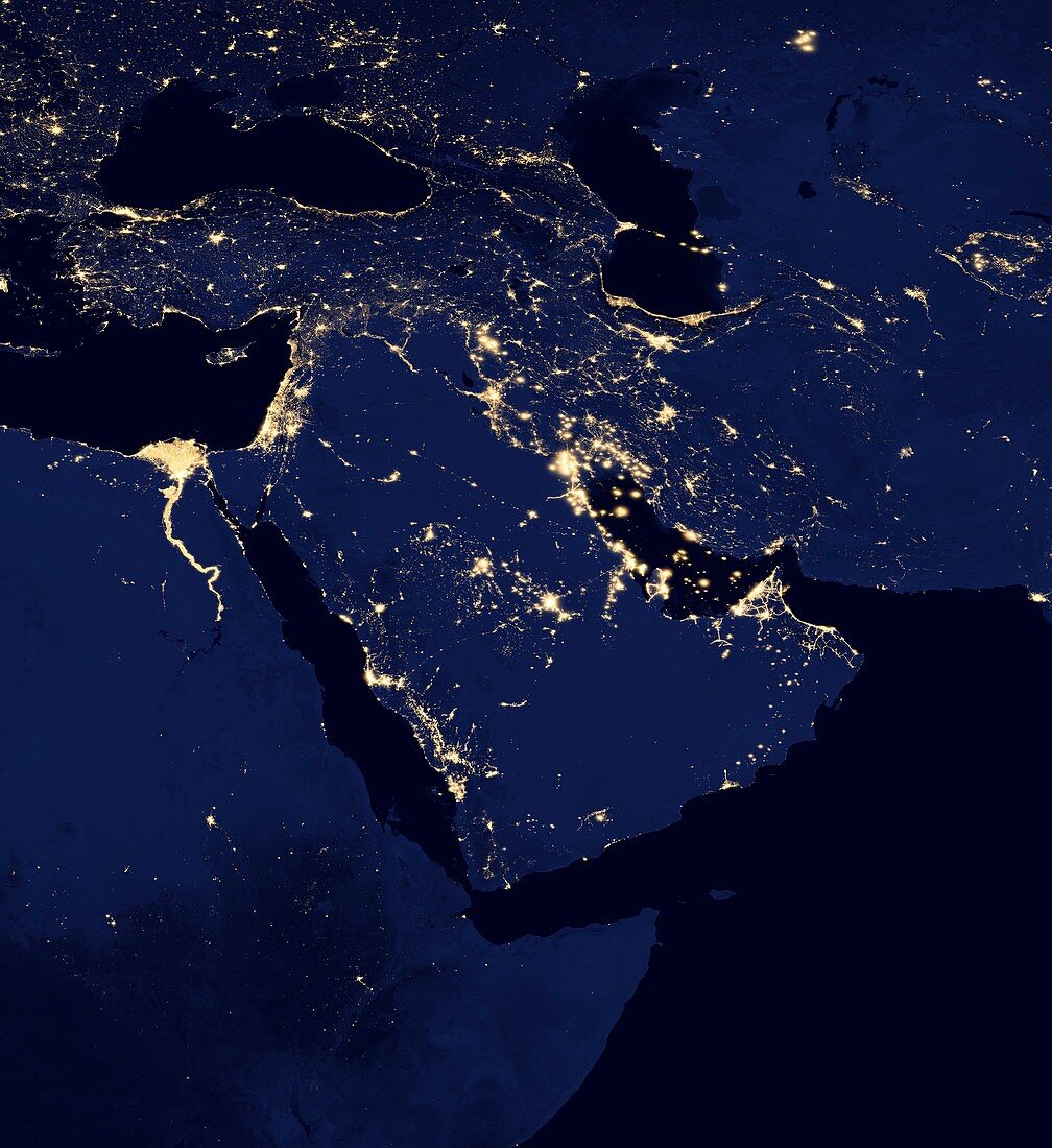
| Middle East at night. Black marble satellite image of the Arabian peninsula at night. More densely populated areas are brighter. Gas flares from oil and gas fields are also seen. Data acquired by the day-night band of the Visible Infrared Imaging Radiometer Suite (VIIRS) on board the NASA-NOAA Suomi National Polar-orbiting Partnership (NPP) satellite,over nine days in April 2012 and 13 days in October 2012 | |
| Lizenzart: | Lizenzpflichtig |
| Credit: | Science Photo Library / NOAA NGDC / NASA EARTH OBSERVATORY |
| Bildgröße: | 4396 px × 4799 px |
| Modell-Rechte: | nicht erforderlich |
| Eigentums-Rechte: | nicht erforderlich |
| Restrictions: | - |
Preise für dieses Bild ab 15 €
Universitäten & Organisationen
(Informationsmaterial Digital, Informationsmaterial Print, Lehrmaterial Digital etc.)
ab 15 €
Redaktionell
(Bücher, Bücher: Sach- und Fachliteratur, Digitale Medien (redaktionell) etc.)
ab 30 €
Werbung
(Anzeigen, Aussenwerbung, Digitale Medien, Fernsehwerbung, Karten, Werbemittel, Zeitschriften etc.)
ab 55 €
Handelsprodukte
(bedruckte Textilie, Kalender, Postkarte, Grußkarte, Verpackung etc.)
ab 75 €
Pauschalpreise
Rechtepakete für die unbeschränkte Bildnutzung in Print oder Online
ab 495 €
Keywords
- 2012,
- 21. Jahrhundert,
- Afrika,
- Afrikanisch,
- Arabische Halbinsel,
- Dunkel,
- Elektrizität,
- Energieverbrauch,
- Erdbeobachtung,
- Erde,
- Fluss,
- Kontinent,
- Land,
- ländlich,
- Licht,
- Lichter,
- Meer,
- Mittlerer Osten,
- Nacht,
- Nachtzeit,
- Nahost,
- Nil,
- Satellit,
- Satellitenbild,
- schwarzer Marmor,
- Stadt,
- Städte,
- städtisch,
- Suomi NPP,
- Tag-Nacht-Band,
- viirs,
- Weltall,
- wolkenfrei