Western Australia
Bildnummer 11639671
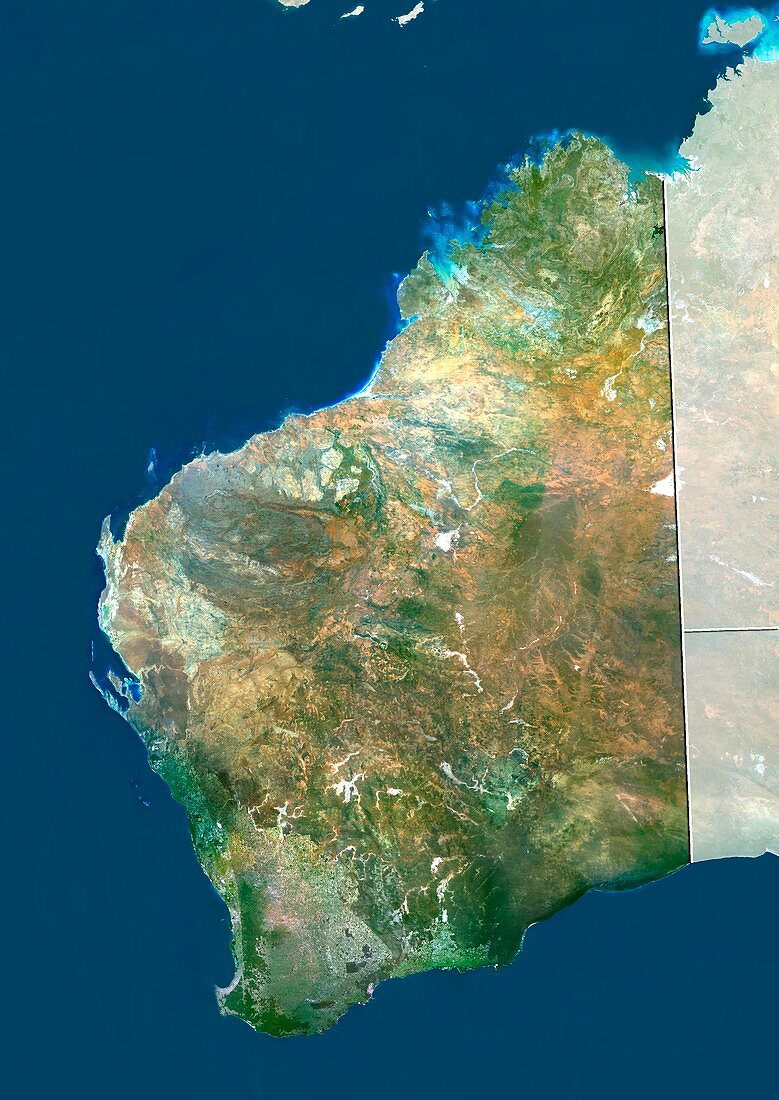
| Western Australia. True colour satellite image showing the state of Western Australia,with the surrounding states and territories shaded out,the Great Australian Bight (blue,bottom right),the Indian Ocean (lower left to top centre) and the Timor Sea (top right). Australia comprises six states: New South Wales,Queensland,South Australia,Tasmania,Victoria,and Western Australia; and two major mainland territories: the Northern Territory and the Australian Capital Territory. Image compiled from data acquired by the LANDSAT 5 and 7 satellites,in 2000. Images highlighting all other regions of this country are available. For further information please contact SPL | |
| Lizenzart: | Lizenzpflichtig |
| Credit: | Science Photo Library / Planetobserver |
| Bildgröße: | 3519 px × 4972 px |
| Modell-Rechte: | nicht erforderlich |
| Restrictions: | - |
Preise für dieses Bild ab 15 €
Universitäten & Organisationen
(Informationsmaterial Digital, Informationsmaterial Print, Lehrmaterial Digital etc.)
ab 15 €
Redaktionell
(Bücher, Bücher: Sach- und Fachliteratur, Digitale Medien (redaktionell) etc.)
ab 30 €
Werbung
(Anzeigen, Aussenwerbung, Digitale Medien, Fernsehwerbung, Karten, Werbemittel, Zeitschriften etc.)
ab 55 €
Handelsprodukte
(bedruckte Textilie, Kalender, Postkarte, Grußkarte, Verpackung etc.)
ab 75 €
Pauschalpreise
Rechtepakete für die unbeschränkte Bildnutzung in Print oder Online
ab 495 €
Keywords
- 2000,
- 21. Jahrhundert,
- Australien,
- australisch,
- Close-up,
- Detail,
- En,
- Erdbeobachtung,
- geografisch,
- Geographie,
- Indischer Ozean,
- Inseln,
- Karte,
- Kartographie,
- Kontinent,
- Land,
- Landsat 7,
- Natur,
- Natürliche Farbe,
- New South Wales,
- Pazifik,
- Queensland,
- Satellit,
- Satellitenbild,
- Staat,
- südlichen Hemisphäre,
- topografisch,
- Topographie,
- Umwelt,
- Victoria,
- Vogelperspektive,
- Von Oben,
- Weltall,
- Westaustralien,
- wolkenlos