Madhya Pradesh,India,satellite image
Bildnummer 11633741
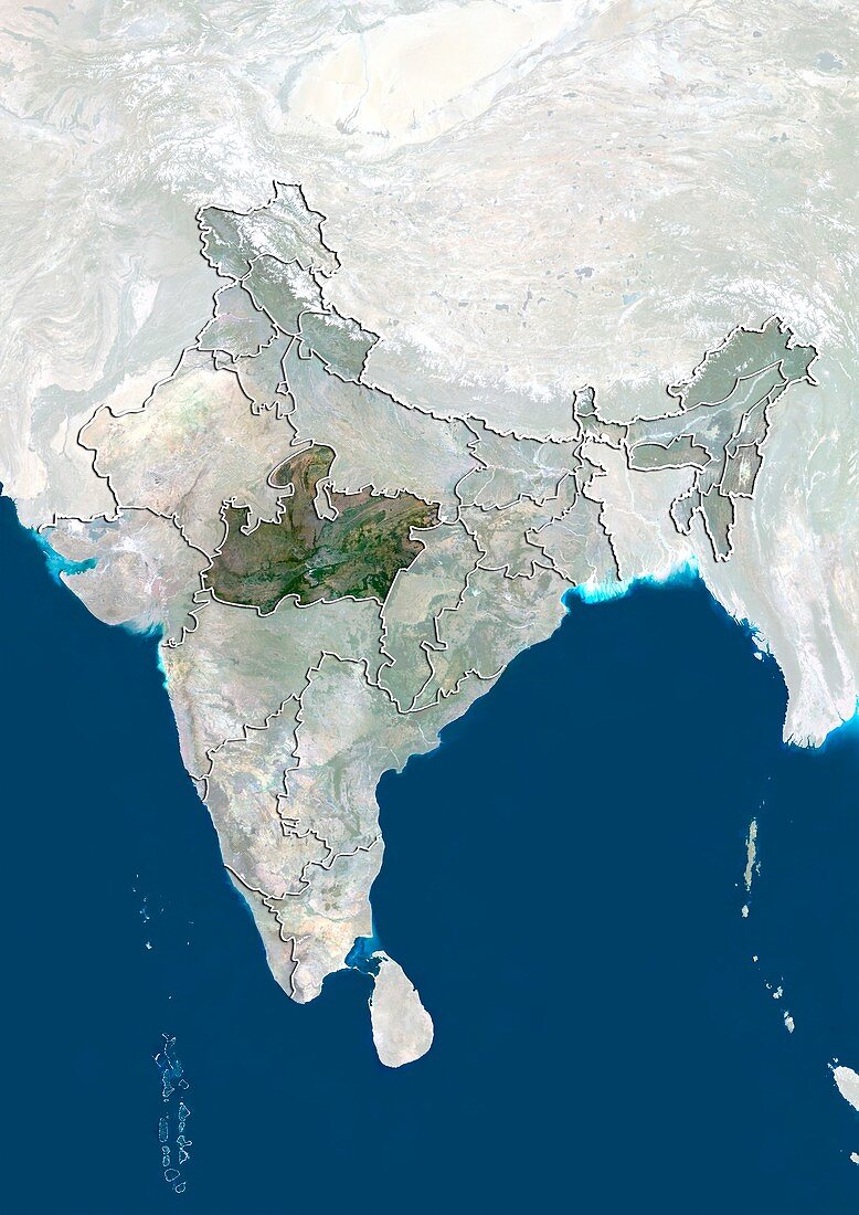
| Madhya Pradesh,satellite image. North is at top. Natural colour satellite image showing the state of Madhya Pradesh,India,with the surrounding Indian states shaded out. The Indian Ocean (blue,bottom),Arabian Sea (blue,lower left),and Bay of Bengal (blue,centre right) can also be seen. India is located in in South Asia and is bordered by Pakistan (upper left),China (top right),Nepal (upper centre),Bhutan (small,centre-right),Burma (far right),and Bangladesh (lower centre-right). Image compiled from data acquired by the LANDSAT 5 and 7 satellites,in 2000. Images highlighting all other regions of this country are available. For further information please contact SPL. Images highlighting all other regions of this country are available. For further information please contact SPL | |
| Lizenzart: | Lizenzpflichtig |
| Credit: | Science Photo Library / Planetobserver |
| Bildgröße: | 3527 px × 4984 px |
| Modell-Rechte: | nicht erforderlich |
| Restrictions: | - |
Preise für dieses Bild ab 15 €
Universitäten & Organisationen
(Informationsmaterial Digital, Informationsmaterial Print, Lehrmaterial Digital etc.)
ab 15 €
Redaktionell
(Bücher, Bücher: Sach- und Fachliteratur, Digitale Medien (redaktionell) etc.)
ab 30 €
Werbung
(Anzeigen, Aussenwerbung, Digitale Medien, Fernsehwerbung, Karten, Werbemittel, Zeitschriften etc.)
ab 55 €
Handelsprodukte
(bedruckte Textilie, Kalender, Postkarte, Grußkarte, Verpackung etc.)
ab 75 €
Pauschalpreise
Rechtepakete für die unbeschränkte Bildnutzung in Print oder Online
ab 495 €
Keywords
- 2000,
- 21. Jahrhundert,
- Asiatisch,
- Asien,
- Bengalen,
- Bhutan,
- Birma,
- China,
- Erdbeobachtung,
- geografisch,
- Geographie,
- Golf von Bengalen,
- Grenze,
- Grenzen,
- Indien,
- Indischer Ozean,
- Karte,
- Kartographie,
- Küste,
- Küsten-,
- Küstenlinie,
- Land,
- Länder,
- Landsat 7,
- Madhya Pradesh,
- maskiert,
- Meer,
- Myanmar,
- Nation,
- Natur,
- Natürliche Farbe,
- Nepal,
- Pakistan,
- Rand,
- Satellit,
- Satellitenbild,
- Staat,
- Südasien,
- topografisch,
- Topographie,
- Ufer,
- Umwelt,
- Vogelperspektive,
- Von Oben,
- Wasser,
- Weltall,
- wolkenlos