Malawi,satellite image
Bildnummer 11629416
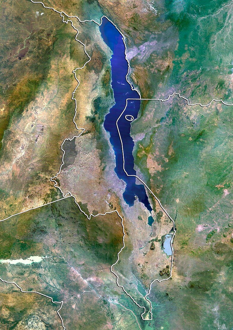
| Malawi,satellite image. North is at top. Natural colour satellite image showing Malawi (centre) and the surrounding territories. Malawi is a landlocked country in southeast Africa. It is bordered by Zambia (upper left),Tanzania (upper right),and Mozambique (lower right to lower left). The country is separated from Tanzania and Mozambique by Lake Malawi (blue),the third largest lake in Africa and the eighth largest in the world. Image compiled from data acquired by the LANDSAT 5 and 7 satellites,in 2000 | |
| Lizenzart: | Lizenzpflichtig |
| Credit: | Science Photo Library / Planetobserver |
| Bildgröße: | 3482 px × 4920 px |
| Modell-Rechte: | nicht erforderlich |
| Restrictions: | - |
Preise für dieses Bild ab 15 €
Universitäten & Organisationen
(Informationsmaterial Digital, Informationsmaterial Print, Lehrmaterial Digital etc.)
ab 15 €
Redaktionell
(Bücher, Bücher: Sach- und Fachliteratur, Digitale Medien (redaktionell) etc.)
ab 30 €
Werbung
(Anzeigen, Aussenwerbung, Digitale Medien, Fernsehwerbung, Karten, Werbemittel, Zeitschriften etc.)
ab 55 €
Handelsprodukte
(bedruckte Textilie, Kalender, Postkarte, Grußkarte, Verpackung etc.)
ab 75 €
Pauschalpreise
Rechtepakete für die unbeschränkte Bildnutzung in Print oder Online
ab 495 €
Keywords
- 2000,
- 21. Jahrhundert,
- Afrika,
- Afrikanisch,
- Binnenstaat,
- Erdbeobachtung,
- geografisch,
- Geographie,
- Grenze,
- Grenzen,
- Karte,
- Kartographie,
- Land,
- Länder,
- Landsat 7,
- Malawi,
- maskiert,
- Nation,
- Natur,
- Natürliche Farbe,
- Rand,
- Satellit,
- Satellitenbild,
- Staat,
- Tansania,
- topografisch,
- Topographie,
- Umwelt,
- Vogelperspektive,
- Von Oben,
- Wasser,
- Weltall