Arctic ice minimum extent,2011
Bildnummer 11621242
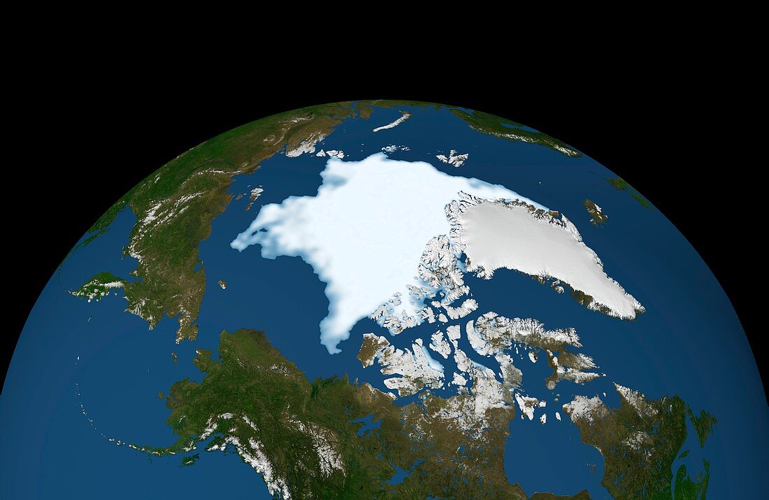
| Arctic ice minimum extent. Satellite image showing the Arctic polar ice cap at its annual minimum extent on 9th September 2011. The Arctic sea ice (white) reaches a minimum in September,at the end of the Arctic summer. This minimal ice area is called the perennial ice cover. The perennial ice has been steadily decreasing since satellites began observing it in 1979,at a rate of about 10 percent per decade. This was the second lowest recorded minimum,at just over 4.3 million square kilometres. This decrease is attributed to global warming. Data from the Special Sensor Microwave Imager (SSMI) instrument on the US Air Force's Defense Meteorological Satellite Program (DMSP) | |
| Lizenzart: | Lizenzpflichtig |
| Credit: | Science Photo Library / NASA's Goddard Space Flight Center / SVS |
| Bildgröße: | 5197 px × 3384 px |
| Modell-Rechte: | nicht erforderlich |
| Eigentums-Rechte: | nicht erforderlich |
| Restrictions: | - |
Preise für dieses Bild ab 15 €
Universitäten & Organisationen
(Informationsmaterial Digital, Informationsmaterial Print, Lehrmaterial Digital etc.)
ab 15 €
Redaktionell
(Bücher, Bücher: Sach- und Fachliteratur, Digitale Medien (redaktionell) etc.)
ab 30 €
Werbung
(Anzeigen, Aussenwerbung, Digitale Medien, Fernsehwerbung, Karten, Werbemittel, Zeitschriften etc.)
ab 55 €
Handelsprodukte
(bedruckte Textilie, Kalender, Postkarte, Grußkarte, Verpackung etc.)
ab 75 €
Pauschalpreise
Rechtepakete für die unbeschränkte Bildnutzung in Print oder Online
ab 495 €
Keywords
- 21. Jahrhundert,
- alljährlich,
- Arktis,
- Arktischer Ozean,
- DMSP,
- Erdbeobachtung,
- Erde,
- geografisch,
- Geographie,
- Globale Erwärmung,
- Klimatologie,
- klimatologisch,
- Klimawandel,
- Meer,
- Meereis,
- Nördlicher Polarkreis,
- Ozean,
- Passage,
- Provinz,
- Region,
- Rückzug,
- Satellit,
- Satellitenbild,
- Schmelzen,
- SSMI,
- Umwelt,
- Verschwinden,
- Weltall