Volcanic destruction
Bildnummer 11617397
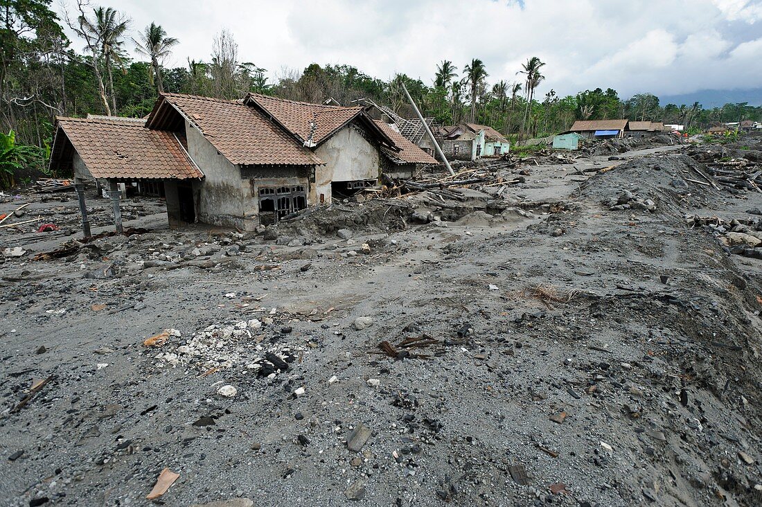
| Volcanic destruction. Buildings at the edge of a pyroclastic flow from the Gunung Merapi (Mount Merapi) volcano. This is one of Indonesia's most active volcanoes,located on the island of Java,28 kilometres north of the city of Yogyakarta. Its elevation in 2011 was 2930 metres. A series of eruptions in October and November 2010 produced pyroclastic flows and lahars (volcanic mud flows). Thought to be the largest eruptions here since the 1870s,over 350,000 people from villages and towns in the area were evacuated,and around 350 died. Photographed in March 2011,at Kepuharjo,Cangkringan,near Yogyakarta | |
| Lizenzart: | Lizenzpflichtig |
| Credit: | Science Photo Library / Oldfield, Matthew |
| Bildgröße: | 3633 px × 2417 px |
| Modell-Rechte: | nicht erforderlich |
| Eigentums-Rechte: | nicht erforderlich |
| Restrictions: | - |
Preise für dieses Bild ab 15 €
Universitäten & Organisationen
(Informationsmaterial Digital, Informationsmaterial Print, Lehrmaterial Digital etc.)
ab 15 €
Redaktionell
(Bücher, Bücher: Sach- und Fachliteratur, Digitale Medien (redaktionell) etc.)
ab 30 €
Werbung
(Anzeigen, Aussenwerbung, Digitale Medien, Fernsehwerbung, Karten, Werbemittel, Zeitschriften etc.)
ab 55 €
Handelsprodukte
(bedruckte Textilie, Kalender, Postkarte, Grußkarte, Verpackung etc.)
ab 75 €
Pauschalpreise
Rechtepakete für die unbeschränkte Bildnutzung in Print oder Online
ab 495 €
Keywords
- 2011,
- 21. Jahrhundert,
- Asiatisch,
- Beschädigt,
- Erdkunde,
- Folge,
- Gebäude,
- Geologie,
- geologisch,
- Gunung Merapi,
- Haus,
- Hütte,
- Indonesien,
- Indonesisch,
- Java,
- März,
- merapi,
- Natur,
- Naturkatastrophe,
- pyroklastischer Strom,
- Schaden,
- Südost asiatisch,
- Südostasien,
- Verwüstung,
- Vulkan,
- vulkanisch,
- Vulkanologie,
- Zerstörung,
- zestört