Global transportation map
Bildnummer 11616478
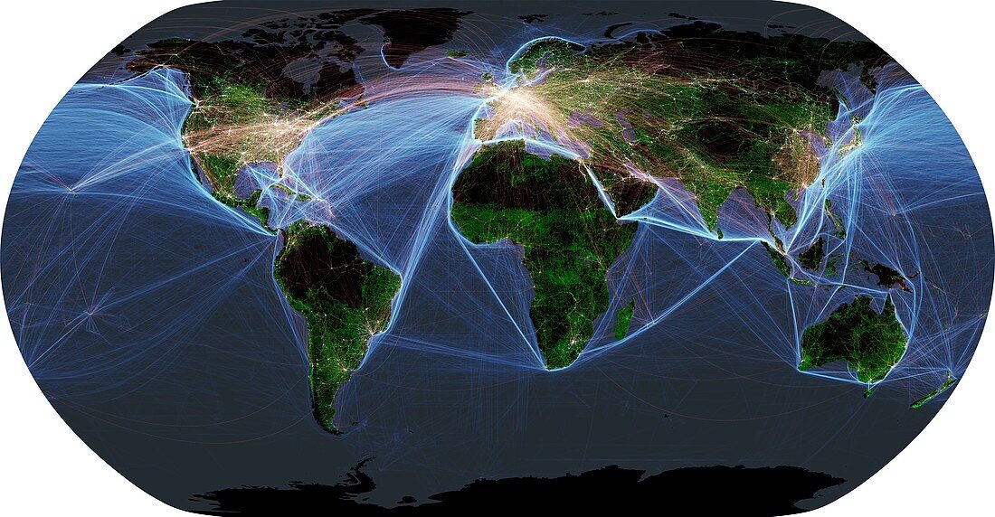
| Global transportation map. Map of the world showing major road networks (green) over land,shipping lanes over water (blue) and airline flight paths (white) superimposed over satellite images of cities illuminated at night (yellow). This image illustrates modern human impact on the planet | |
| Lizenzart: | Lizenzpflichtig |
| Credit: | Science Photo Library / Pharand-Deschenes, Felix |
| Bildgröße: | 5837 px × 3035 px |
| Modell-Rechte: | nicht erforderlich |
| Eigentums-Rechte: | nicht erforderlich |
| Restrictions: | - |
Preise für dieses Bild ab 15 €
Universitäten & Organisationen
(Informationsmaterial Digital, Informationsmaterial Print, Lehrmaterial Digital etc.)
ab 15 €
Redaktionell
(Bücher, Bücher: Sach- und Fachliteratur, Digitale Medien (redaktionell) etc.)
ab 30 €
Werbung
(Anzeigen, Aussenwerbung, Digitale Medien, Fernsehwerbung, Karten, Werbemittel, Zeitschriften etc.)
ab 55 €
Handelsprodukte
(bedruckte Textilie, Kalender, Postkarte, Grußkarte, Verpackung etc.)
ab 75 €
Pauschalpreise
Rechtepakete für die unbeschränkte Bildnutzung in Print oder Online
ab 495 €
Keywords
- 21. Jahrhundert,
- Afrika,
- Afrikanisch,
- Amerikanisch,
- Anthropozän,
- Asiatisch,
- Asien,
- Australien,
- australisch,
- Dritte Welt,
- Erdbeobachtung,
- Eurasien,
- Eurasisch,
- Europa,
- europäisch,
- geografisch,
- Geographie,
- Illustration,
- Kabel,
- Karte,
- menschliche Präsenz,
- modern,
- Modernität,
- Nachtzeit,
- Netzwerk,
- Nordamerika,
- Planet,
- Route,
- Routen,
- Satellit,
- Satellitenbild,
- Schienen,
- Stadt,
- Stadt in der Nacht,
- Städte,
- Straße,
- Südamerika,
- Transport,
- USA,
- Vereinigte Staaten,
- Vereinigtes Königreich,
- Welt in der Nacht,
- weltweit