Sydney Cove,18th-century Australia
Bildnummer 11607446
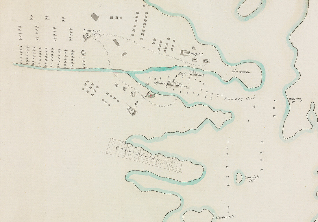
| Sydney Cove. Close-up of the Sydney Cove portion of an 18th-century map of the larger bay known as Port Jackson,in New South Wales,Australia. The map,which dates from October 1788,includes illustrations of ship navigation routes,a hospital,agricultural fields,Convicts Island,and the Lieutenant-Governor's house. The map,an unattributed work by a Port Jackson painter,is part of the Watling Collection at the Natural History Museum,London,UK | |
| Lizenzart: | Lizenzpflichtig |
| Credit: | Science Photo Library / Natural History Museum, London |
| Bildgröße: | 5005 px × 3491 px |
| Modell-Rechte: | nicht erforderlich |
| Restrictions: | - |
Preise für dieses Bild ab 15 €
Universitäten & Organisationen
(Informationsmaterial Digital, Informationsmaterial Print, Lehrmaterial Digital etc.)
ab 15 €
Redaktionell
(Bücher, Bücher: Sach- und Fachliteratur, Digitale Medien (redaktionell) etc.)
ab 30 €
Werbung
(Anzeigen, Aussenwerbung, Digitale Medien, Fernsehwerbung, Karten, Werbemittel, Zeitschriften etc.)
ab 55 €
Handelsprodukte
(bedruckte Textilie, Kalender, Postkarte, Grußkarte, Verpackung etc.)
ab 75 €
Pauschalpreise
Rechtepakete für die unbeschränkte Bildnutzung in Print oder Online
ab 495 €
Keywords
- 1700er Jahre,
- 18. Jahrhundert,
- Australien,
- australisch,
- Boot,
- Boote,
- Bucht,
- Diagramm,
- Erkundung,
- Felder,
- geografisch,
- Geographie,
- Geschichte,
- Hafen,
- Häuser,
- historisch,
- Illustration,
- Insel,
- Karte,
- Kolonial,
- Kolonie,
- Krankenhaus,
- Kunstwerk,
- Küste,
- Küsten-,
- Küstenlinie,
- Landwirtschaft,
- Maisfelder,
- Naturgeschichte,
- Naturkundemuseum,
- New South Wales,
- Oktober,
- Port Jackson,
- Port Jackson Maler,
- Routen,
- Schiff,
- Schiffe,
- Siedlung,
- Sydney,
- Sydney Cove,
- Tiefe