Palm Jumeirah,satellite radar image
Bildnummer 11594149
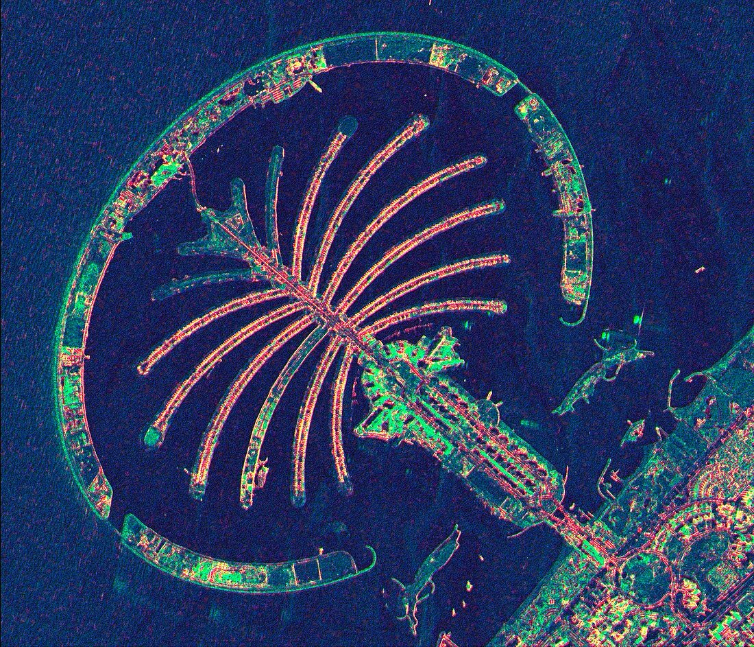
| Palm Jumeirah,satellite radar image. North is at top. The Palm Jumeirah is a collection of artificial islands built in the shape of a palm tree on the Persian Gulf coast of Dubai,in the United Arab Emirates (UAE). Construction began in 2001,with some hotels and apartments in use by 2008. The colours in the image indicate different reflectivity of the radar used to obtain the image. This image,showing an area around 6.6 kilometres across,was obtained by the TerraSAR-X satellite on 16 March 2008. This is a European satellite that uses X-band (microwave) synthetic aperture radar (SAR) to observe the Earth from space | |
| Lizenzart: | Lizenzpflichtig |
| Credit: | Science Photo Library / Infoterra |
| Bildgröße: | 3513 px × 3012 px |
| Modell-Rechte: | nicht erforderlich |
| Eigentums-Rechte: | nicht erforderlich |
| Restrictions: | - |
Preise für dieses Bild ab 15 €
Universitäten & Organisationen
(Informationsmaterial Digital, Informationsmaterial Print, Lehrmaterial Digital etc.)
ab 15 €
Redaktionell
(Bücher, Bücher: Sach- und Fachliteratur, Digitale Medien (redaktionell) etc.)
ab 30 €
Werbung
(Anzeigen, Aussenwerbung, Digitale Medien, Fernsehwerbung, Karten, Werbemittel, Zeitschriften etc.)
ab 55 €
Handelsprodukte
(bedruckte Textilie, Kalender, Postkarte, Grußkarte, Verpackung etc.)
ab 75 €
Pauschalpreise
Rechtepakete für die unbeschränkte Bildnutzung in Print oder Online
ab 495 €