Layered Martian terrain,satellite image
Bildnummer 11568935
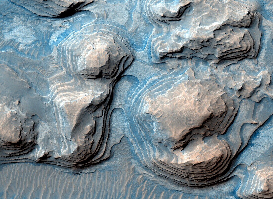
| Layered Martian terrain. Coloured satellite image of layered rocks in Arabia Terra,northern Mars. The rocks have layers of roughly uniform depth. They were formedwhen environmental conditions repeated at regular intervals,a process known as cyclic bedding. Image obtained by the High Resolution Imaging Science Experiment (HiRISE) camera on NASA's Mars Reconnaissance Orbiter (MRO) on 24th July 2009. The width of this image is roughly 1.3 kilometres across | |
| Lizenzart: | Lizenzpflichtig |
| Credit: | Science Photo Library / NASA / JPL / University of Arizona |
| Bildgröße: | 4857 px × 3543 px |
| Modell-Rechte: | nicht erforderlich |
| Eigentums-Rechte: | nicht erforderlich |
| Restrictions: | - |
Preise für dieses Bild ab 15 €
Universitäten & Organisationen
(Informationsmaterial Digital, Informationsmaterial Print, Lehrmaterial Digital etc.)
ab 15 €
Redaktionell
(Bücher, Bücher: Sach- und Fachliteratur, Digitale Medien (redaktionell) etc.)
ab 30 €
Werbung
(Anzeigen, Aussenwerbung, Digitale Medien, Fernsehwerbung, Karten, Werbemittel, Zeitschriften etc.)
ab 55 €
Handelsprodukte
(bedruckte Textilie, Kalender, Postkarte, Grußkarte, Verpackung etc.)
ab 75 €
Pauschalpreise
Rechtepakete für die unbeschränkte Bildnutzung in Print oder Online
ab 495 €