New York City,USA,satellite image
Bildnummer 11555136
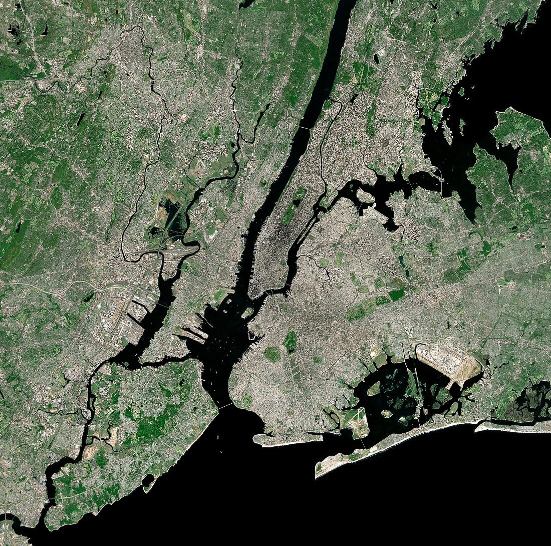
| New York city,USA,and its surrounding area,satellite image. North is at top. The island of Manhattan is at upper centre,bordered by the Hudson (left) and East (right) rivers. Brooklyn is at centre right,Staten Island is at bottom left and New Jersey is at left. Forested areas are dark green,agricultural fields are lighter shades of green and brown,urban areas are grey,and water is black. Image created using NaturalVue data obtained from the Landsat 7 satellite | |
| Lizenzart: | Lizenzpflichtig |
| Credit: | Science Photo Library / MDA Information Systems |
| Bildgröße: | 4211 px × 4174 px |
| Modell-Rechte: | nicht erforderlich |
| Eigentums-Rechte: | nicht erforderlich |
| Restrictions: | - |
Preise für dieses Bild ab 15 €
Universitäten & Organisationen
(Informationsmaterial Digital, Informationsmaterial Print, Lehrmaterial Digital etc.)
ab 15 €
Redaktionell
(Bücher, Bücher: Sach- und Fachliteratur, Digitale Medien (redaktionell) etc.)
ab 30 €
Werbung
(Anzeigen, Aussenwerbung, Digitale Medien, Fernsehwerbung, Karten, Werbemittel, Zeitschriften etc.)
ab 55 €
Handelsprodukte
(bedruckte Textilie, Kalender, Postkarte, Grußkarte, Verpackung etc.)
ab 75 €
Pauschalpreise
Rechtepakete für die unbeschränkte Bildnutzung in Print oder Online
ab 495 €
Keywords
- Ackerland,
- Amerikanisch,
- Atlantikküste,
- Brooklyn,
- Erdbeobachtung,
- Feld,
- Felder,
- Fluss,
- geografisch,
- Geographie,
- Insel,
- Landsat 7,
- Manhattan,
- NASA,
- NaturalVue,
- Natürliche Farbe,
- New Jersey,
- New York,
- New York City,
- Nordamerika,
- NYC,
- Ostküste,
- Satellit,
- Satellitenbild,
- Stadt,
- städtisch,
- Staten Island,
- Urbanisierung,
- USA,
- Vegetation,
- Vereinigte Staaten,
- Wald,
- Wälder,
- Wasser,
- Weltall