Walltown Crags, Hadrian's Wall, c2nd century, illustration
Bildnummer 13755727
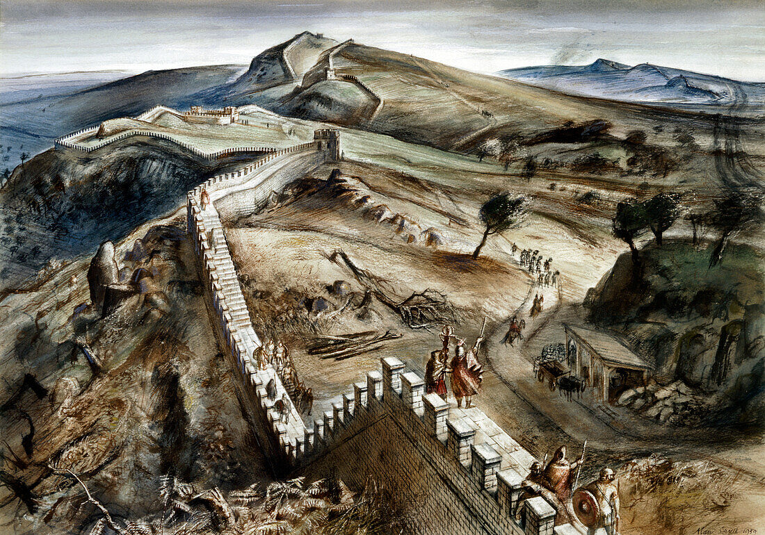
| Walltown Crags, Hadrian's Wall, c2nd century, (c1960s). Reconstruction drawing. A defensive fortification in the Roman province of Britannia, begun in 122 AD in the reign of the emperor Hadrian. It ran from the banks of the River Tyne near the North Sea to the Solway Firth on the Irish Sea, and was the northern limit of the Roman Empire. Walltown Crags is perhaps the most scenic place to view Hadrian's Wall. | |
| Lizenzart: | Lizenzpflichtig |
| Credit: | Science Photo Library / HERITAGE IMAGES / HISTORIC ENGLAND |
| Bildgröße: | 5000 px × 3499 px |
| Modell-Rechte: | nicht erforderlich |
| Eigentums-Rechte: | nicht erforderlich |
| Restrictions: | - |
Preise für dieses Bild ab 15 €
Universitäten & Organisationen
(Informationsmaterial Digital, Informationsmaterial Print, Lehrmaterial Digital etc.)
ab 15 €
Redaktionell
(Bücher, Bücher: Sach- und Fachliteratur, Digitale Medien (redaktionell) etc.)
ab 30 €
Werbung
(Anzeigen, Aussenwerbung, Digitale Medien, Fernsehwerbung, Karten, Werbemittel, Zeitschriften etc.)
ab 55 €
Handelsprodukte
(bedruckte Textilie, Kalender, Postkarte, Grußkarte, Verpackung etc.)
ab 75 €
Pauschalpreise
Rechtepakete für die unbeschränkte Bildnutzung in Print oder Online
ab 495 €
Keywords
- 1960er Jahre,
- 20. Jahrhundert,
- Aussicht,
- britisch,
- Defensive,
- England,
- Englisch,
- Entfernung,
- erhöhte Ansicht,
- Gebäude,
- Geographie,
- geographische Eigenschaft,
- Großbritannien,
- Hadrian,
- Historisch,
- Hügel,
- Illustration,
- Italien,
- Jahrhundert,
- Krieg,
- Kunst,
- Künste,
- Kunstwerk,
- Land,
- Landschaft,
- Niemand,
- Rom,
- Römisch,
- sechziger Jahre,
- Soldat,
- Soldaten,
- szenisch,
- Verteidigung,
- Wiederaufbau,
- Zeichnung