Agriculture around Lake Nasser, Egypt, satellite image
Bildnummer 13672021
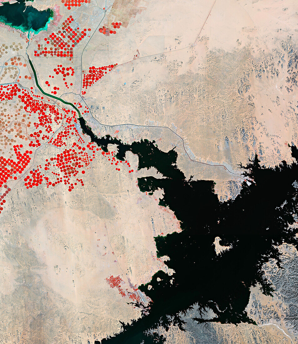
| Composite infrared satellite image of Lake Nasser (bottom right), Egypt, and surrounding agricultural land. Vegetation is red. The red circular areas are pivot irrigation fields. Lake Nasser is a large lake, measuring 550 kilometres long, formed as a result of the Aswan High Dam across the River Nile. Data obtained by the Copernicus Sentinel-2 satellite. | |
| Lizenzart: | Lizenzpflichtig |
| Credit: | Science Photo Library / ESA |
| Bildgröße: | 7334 px × 8468 px |
| Modell-Rechte: | nicht erforderlich |
| Eigentums-Rechte: | nicht erforderlich |
| Restrictions: |
|
Preise für dieses Bild ab 15 €
Universitäten & Organisationen
(Informationsmaterial Digital, Informationsmaterial Print, Lehrmaterial Digital etc.)
ab 15 €
Redaktionell
(Bücher, Bücher: Sach- und Fachliteratur, Digitale Medien (redaktionell) etc.)
ab 30 €
Werbung
(Anzeigen, Aussenwerbung, Digitale Medien, Fernsehwerbung, Karten, Werbemittel, Zeitschriften etc.)
ab 55 €
Handelsprodukte
(bedruckte Textilie, Kalender, Postkarte, Grußkarte, Verpackung etc.)
ab 75 €
Pauschalpreise
Rechtepakete für die unbeschränkte Bildnutzung in Print oder Online
ab 495 €