British Isles, satellite image
Bildnummer 13614033
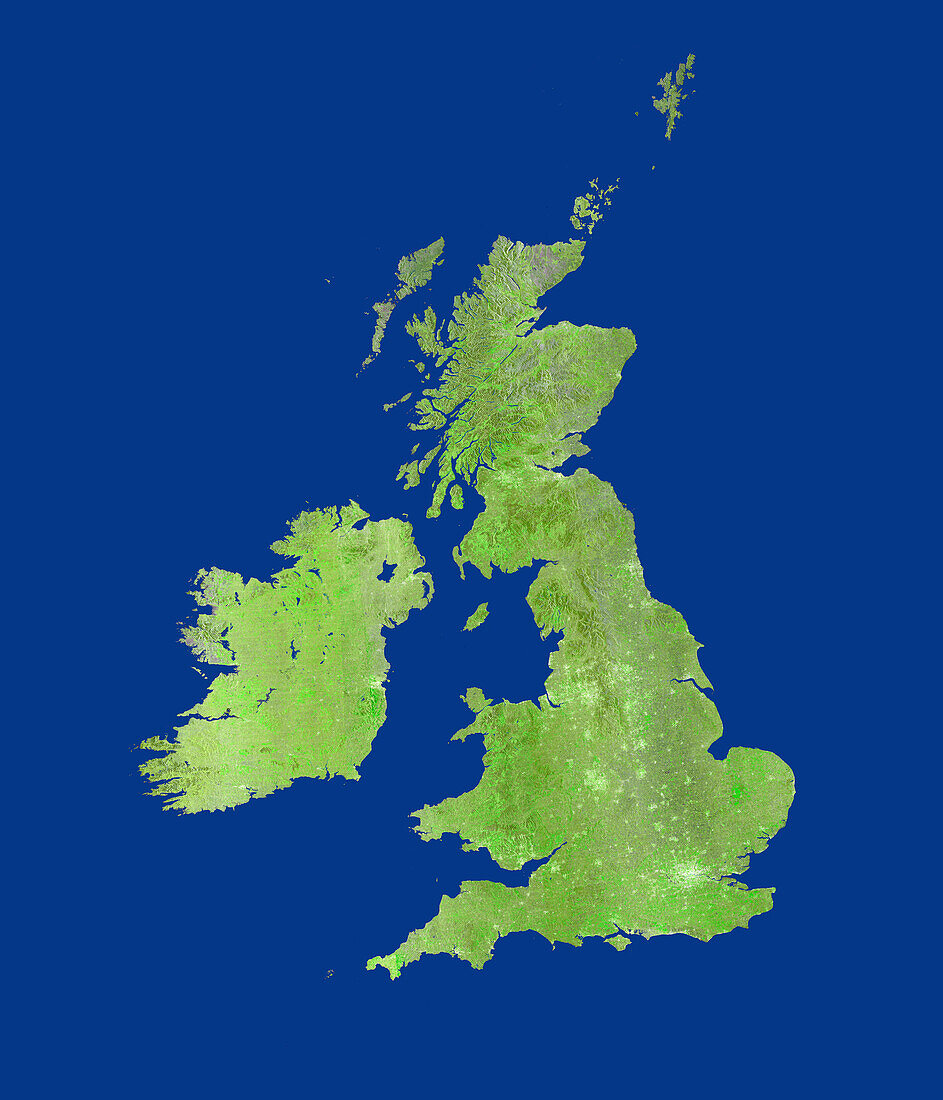
| British Isles, satellite image. Major cities and populated areas in the United Kingdom and Ireland appear bright. This is a mosaic of seven images obtained in December 2021 by the NovaSAR-1 satellite. Synthetic aperture radar (SAR) is able to see through cloud cover and discriminate very well between different types of land cover. | |
| Lizenzart: | Lizenzpflichtig |
| Credit: | Science Photo Library / AIRBUS DEFENCE AND SPACE |
| Bildgröße: | 5487 px × 6402 px |
| Modell-Rechte: | nicht erforderlich |
| Eigentums-Rechte: | nicht erforderlich |
| Restrictions: | - |
Preise für dieses Bild ab 15 €
Universitäten & Organisationen
(Informationsmaterial Digital, Informationsmaterial Print, Lehrmaterial Digital etc.)
ab 15 €
Redaktionell
(Bücher, Bücher: Sach- und Fachliteratur, Digitale Medien (redaktionell) etc.)
ab 30 €
Werbung
(Anzeigen, Aussenwerbung, Digitale Medien, Fernsehwerbung, Karten, Werbemittel, Zeitschriften etc.)
ab 55 €
Handelsprodukte
(bedruckte Textilie, Kalender, Postkarte, Grußkarte, Verpackung etc.)
ab 75 €
Pauschalpreise
Rechtepakete für die unbeschränkte Bildnutzung in Print oder Online
ab 495 €
Keywords
- 21. Jahrhundert,
- Atlantischer Ozean,
- Britische Inseln,
- Dezember,
- Dublin,
- Edinburgh,
- England,
- Erdbeobachtung,
- Europa,
- europäisch,
- geografisch,
- Geographie,
- Glasgow,
- Großbritannien,
- Insel,
- Inseln,
- Irland,
- Küste,
- Küsten-,
- London,
- Manchester,
- Mosaik-,
- Nordirland,
- Nordsee,
- Satellitenbild,
- Schottland,
- Stadt,
- Städte,
- städtisch,
- Umwelt,
- Vereinigtes Königreich,
- Wales,
- Weltall,
- Windpark,
- wolkenfrei,
- wolkenlos,
- Zusammengesetzt