Mauritanian coast, satellite image
Bildnummer 13525378
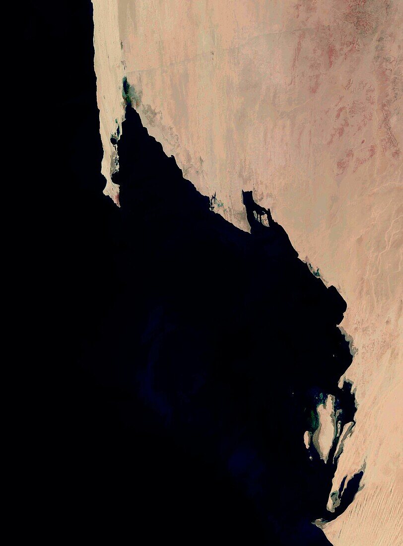
| Satellite image of part of the coast of Mauritania in northwest Africa. At top left is the Ras Nouadhibou peninsula, which is 60 kilometres long and is divided between Mauritania and Western Sahara. The land at right, from roughly in line with the end of Ras Nouadhibou downwards, constitutes Banc d'Arguin National Park, which is a major breeding site for migratory birds. Data obtained by the Landsat 8 satellite between 2nd and 13th January 2022. | |
| Lizenzart: | Lizenzpflichtig |
| Credit: | Science Photo Library / US Geological Survey |
| Bildgröße: | 5081 px × 6880 px |
| Modell-Rechte: | nicht erforderlich |
| Eigentums-Rechte: | nicht erforderlich |
| Restrictions: | - |
Preise für dieses Bild ab 15 €
Universitäten & Organisationen
(Informationsmaterial Digital, Informationsmaterial Print, Lehrmaterial Digital etc.)
ab 15 €
Redaktionell
(Bücher, Bücher: Sach- und Fachliteratur, Digitale Medien (redaktionell) etc.)
ab 30 €
Werbung
(Anzeigen, Aussenwerbung, Digitale Medien, Fernsehwerbung, Karten, Werbemittel, Zeitschriften etc.)
ab 55 €
Handelsprodukte
(bedruckte Textilie, Kalender, Postkarte, Grußkarte, Verpackung etc.)
ab 75 €
Pauschalpreise
Rechtepakete für die unbeschränkte Bildnutzung in Print oder Online
ab 495 €