Open pit mines in the Amazon, satellite image
Bildnummer 13445271
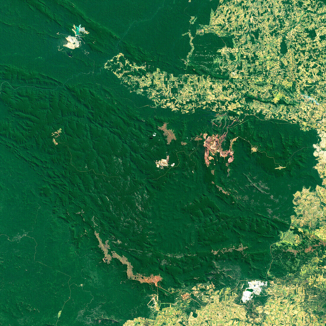
| Satellite image of open pit mines in the Carajás Mountains in the Brazilian Amazon. The largest mine, the Serre Norte complex, is the red area at centre right. To its lower left is the Blue Mine, and at bottom right is the Sossego Mine (white). This area is mined for metal ores, including iron, copper and gold. Image obtained by the Operational Land Imager (OLI) on the Landsat 8 satellite on 16th July 2018. | |
| Lizenzart: | Lizenzpflichtig |
| Credit: | Science Photo Library / U.S. Geological Survey / NASA Earth Observatory |
| Bildgröße: | 5912 px × 5912 px |
| Modell-Rechte: | nicht erforderlich |
| Eigentums-Rechte: | nicht erforderlich |
| Restrictions: | - |
Preise für dieses Bild ab 15 €
Universitäten & Organisationen
(Informationsmaterial Digital, Informationsmaterial Print, Lehrmaterial Digital etc.)
ab 15 €
Redaktionell
(Bücher, Bücher: Sach- und Fachliteratur, Digitale Medien (redaktionell) etc.)
ab 30 €
Werbung
(Anzeigen, Aussenwerbung, Digitale Medien, Fernsehwerbung, Karten, Werbemittel, Zeitschriften etc.)
ab 55 €
Handelsprodukte
(bedruckte Textilie, Kalender, Postkarte, Grußkarte, Verpackung etc.)
ab 75 €
Pauschalpreise
Rechtepakete für die unbeschränkte Bildnutzung in Print oder Online
ab 495 €