British Columbia wildfire, June 2021
Bildnummer 13444859
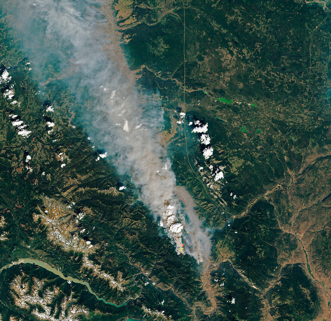
| Composite satellite image of the McKay Creek wildfire in British Columbia, Canada. Shortwave-infrared data has been overlaid on a natural-colour image to highlight areas of active fire (red and orange). This is one of more than 40 wildfires in British Columbia at the time. The fires occurred during a period of record-breaking high temperature across western Canada. Data obtained by the Operational Land Imager (OLI) on the Landsat 8 satellite on 30th June 2021. | |
| Lizenzart: | Lizenzpflichtig |
| Credit: | Science Photo Library / U.S. Geological Survey / NASA Earth Observatory |
| Bildgröße: | 4278 px × 4159 px |
| Modell-Rechte: | nicht erforderlich |
| Eigentums-Rechte: | nicht erforderlich |
| Restrictions: | - |
Preise für dieses Bild ab 15 €
Universitäten & Organisationen
(Informationsmaterial Digital, Informationsmaterial Print, Lehrmaterial Digital etc.)
ab 15 €
Redaktionell
(Bücher, Bücher: Sach- und Fachliteratur, Digitale Medien (redaktionell) etc.)
ab 30 €
Werbung
(Anzeigen, Aussenwerbung, Digitale Medien, Fernsehwerbung, Karten, Werbemittel, Zeitschriften etc.)
ab 55 €
Handelsprodukte
(bedruckte Textilie, Kalender, Postkarte, Grußkarte, Verpackung etc.)
ab 75 €
Pauschalpreise
Rechtepakete für die unbeschränkte Bildnutzung in Print oder Online
ab 495 €
Keywords
- 2000er Jahre,
- 21. Jahrhundert,
- Atmosphäre,
- atmosphärisch,
- British Columbia,
- Erdbeobachtung,
- Erde,
- Feuer,
- Globale Erwärmung,
- Kanada,
- Kanadisch,
- Klimatologie,
- klimatologisch,
- Klimawandel,
- Landsat 8,
- Naturkatastrophe,
- Niemand,
- Nordamerika,
- nordamerikanisch,
- oli,
- Rauch,
- Satellit,
- Satellitenbild,
- Umwelt,
- Verschmutzung,
- Weltall,
- Westküste,
- Zusammengesetzt